September 8, 2026 · Travel Diary
Two photos of Tianchi Lake cannot be taken as the same place
Arxan Heavenly Lake and Camel’s Hump Ridge Heavenly Lake are two distinct attractions. Be sure to distinguish their names before your trip to understand the relationship between the photos and the actual route. Aerial photos often show the entire lake nestled within the mountains and forests, with its outline clearly visible; however, the view from the ground trails is limited by the terrain, trees, and vantage point.
The images accompanying this article are two aerial shots of Tianchi Lake, with their sources clearly labeled in the original posts. While they help illustrate the overall relationship between the lake and the forest, they do not guarantee that visitors will see the same view from the boardwalk, nor do they constitute advice on aerial photography. Only by clearly explaining the perspective of the images can we keep our expectations grounded in a realistic and achievable travel experience.
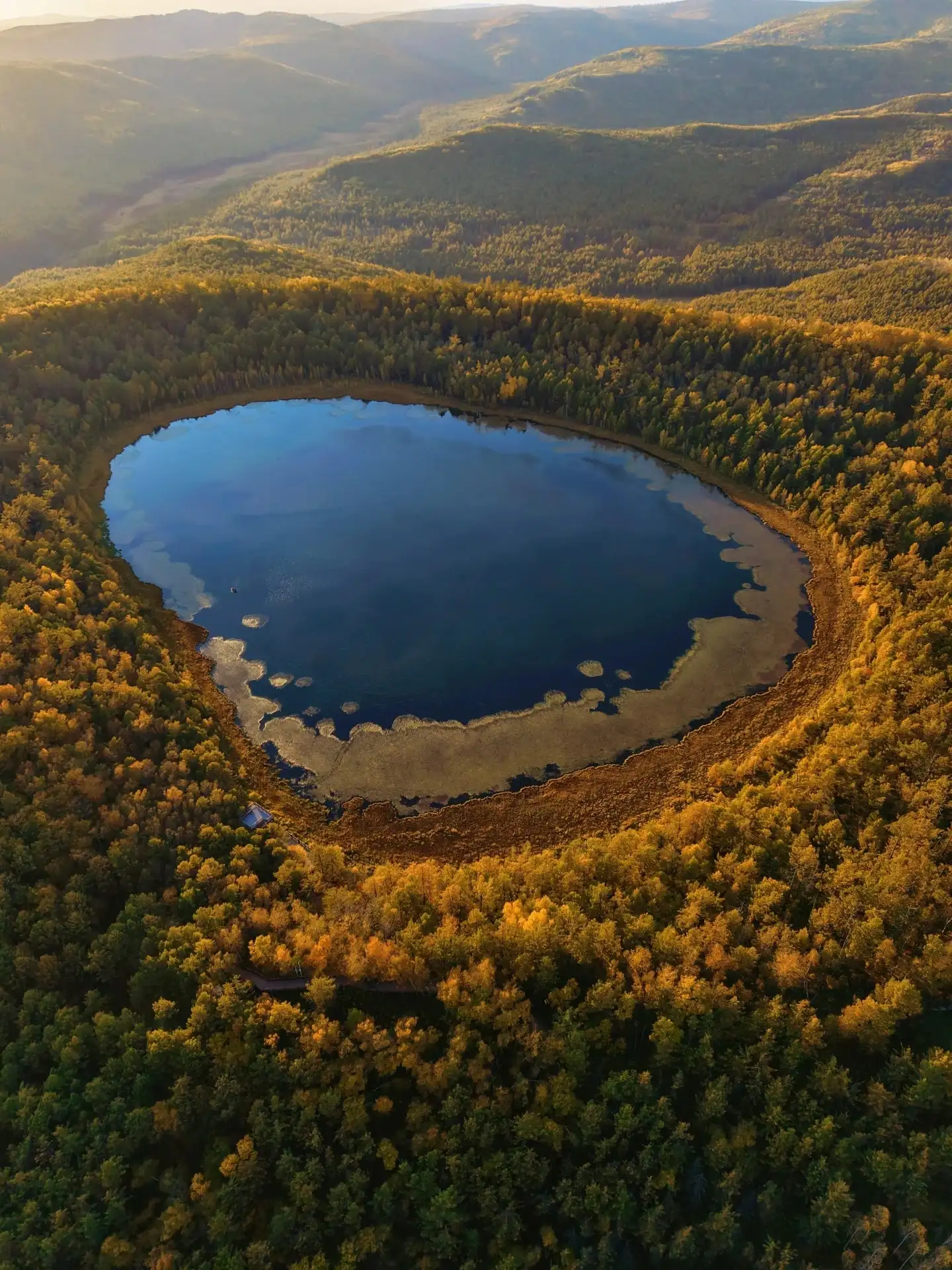
Aerial view of the lake and forest labeled as “Arxan Heavenly Lake” in the source note.
What the volcano left behind is more than just a mountain
The official description of Arxan National Forest Park lists volcanic remnants, forests, and lakes as its key attractions. When viewing the landscape here, you can think of the lake’s surface as a gateway, leading your gaze to the surrounding slopes, woodlands, and rocks along the way. Why does water appear in certain places, and how does the surrounding terrain change? These questions transform the scenery from mere color into a complex structure.
vary from lake to lake, as their formation processes are not entirely the same. Existing geological studies classify Arxan Heavenly Lake as a crater lake and Azalea Lake as a volcanic dammed lake. These two terms indicate different geological processes and are best understood in conjunction with the on-site educational signs; for rocks without reliable explanations, visitors should not attempt to determine the era of eruption or rock type based solely on their appearance.
Tufengling Heavenly Lake: Combining the Ascent with the Panoramic View
A visit to Tuofengling Heavenly Lake involves an ascent along the trail. Along the way, you’ll first encounter nearby tree trunks and foliage; only after reaching a suitable vantage point does the lake come into a more expansive view. This transition from the forest to the lake often leaves a deeper impression than quickly arriving at a viewing platform.
Rather than memorizing the exact number of steps from a travelogue in advance, it’s better to plan your stops based on the currently open trails, your physical stamina, and the weather. When cloud cover is thick, the water may appear deep and dark; when sunlight hits the lake’s surface, the glare may obscure some details. Tianchi Lake does not always appear as a uniform shade of blue or green; the ever-changing scenery is itself part of the experience of viewing the lake from above.
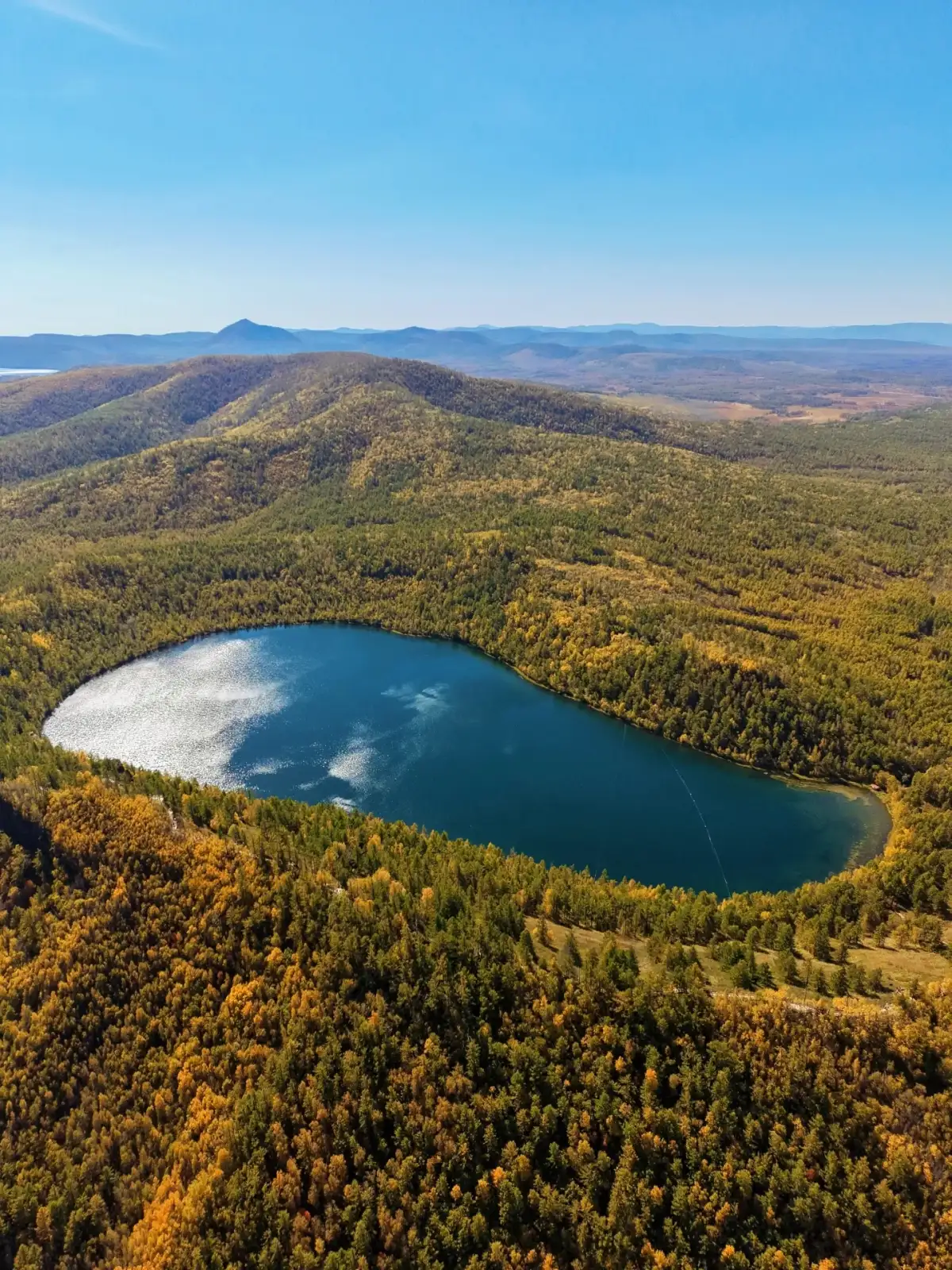
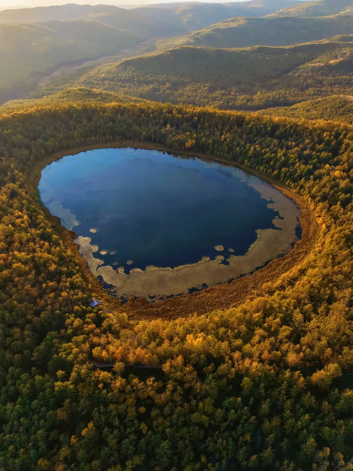
Aerial view of the lake and forest labeled in the source note as “Tuofengling Heavenly Lake.”
Azalea Lake is the perfect spot to lower your gaze
offer a perspective on Azalea Lake that sets it apart from Tianchi Lake. Focus your gaze at a height close to the shore, observing how the rocks dip into the water, how the trees line the shore, and what colors the water’s surface reflects up close. The details of the lakeshore do not rely on a single, complete bird’s-eye view; walking just a short distance allows the foreground to constantly shift.
Just because “azalea” is in the name doesn’t mean you’ll see flowers in every season. Even outside the blooming season, you can still appreciate the trees, water, and shorelines—and autumn doesn’t need to be defined by spring’s floral scenery. Before setting out, decide whether your focus for this trip is on the blooms, the colors of the forest, or the distinct landforms, and then make your choice based on the season. This approach is likely to yield a more specific answer than a vague search for the “best season.”
Identifying the different contours within the mountain range using two aerial photos
The Arxan Heavenly Lake shown in the accompanying image is nearly circular, with a distinct ring of forest forming around its waters; the Tuofengling Heavenly Lake, on the other hand, features a more expansive, undulating outline, with its shores interlocking with the surrounding undulating terrain. By comparing the two images side by side in your mind, it becomes easy to see why they should not be regarded as different angles of the same landscape.
may not reveal their full contours during a ground-level tour, but you can still observe how the lakeshore curves within your field of view and how the opposite slope rises from the water’s edge. By connecting these local observations with the overall image you’ve seen beforehand, ascending to a higher vantage point becomes more than just waiting for a standard panoramic shot—it’s a gradual process of understanding your own position within the mountain landscape.
The color of the lake surface, however, is not a reliable indicator for identifying locations. Sunlight, cloud shadows, viewing angle, and camera processing can all alter the color, so the same lake may look very different in different photos. More reliable are clearly identified place names, locations on maps, and recognizable topographical features. When you look at the lake with these clues in mind, details beyond just the color will gradually come into focus.
The forest is not a static golden backdrop
Autumn imagery often makes Arxan appear entirely golden, but the colors may vary depending on tree species, slope orientation, and the time of day. The interplay of yellow, deep green, and brown in the accompanying photo illustrates precisely that the forest is not a uniform canvas of color. When you actually venture into it, you’ll encounter even more details revealed by the textures of the bark, the ground surface, and the structure of the branches and trunks.
can be explored by selecting a close-up view along an open trail and then looking up to compare it with the distant slopes. Up close, you can see individual trees; from a distance, you see vast canopies. These two scales together give the forest its depth. Don’t mistake the sparse landscape after the leaves have fallen for a “disappearance of the scenery”—at that time, the contours of the mountains and branches may actually be even clearer.
guide the route to follow the landscape.
Transportation connections are needed between various points within the forest park, and the city center of Arxan is not the same as the park entrance. When planning your trip, first check the current transportation options and open areas within the park, then allocate time for two or three locations you truly want to see. Combining the high-altitude Heavenly Lake with a stretch of lakeshore typically highlights the diversity of the scenery better than trying to cram every named attraction into a single day.
Meals and lodging serve as practical considerations for planning your itinerary: where to start, where to return for dinner after finishing, and whether another long-distance trip is necessary—all of these factors are more important than the straight-line distance shown in photos. This section of the Arxan journey is already rich enough in content; the lake on the hillside and the rocks along the shore each deserve some time. Only by viewing them separately and then connecting them in your memory can you easily understand why the forest has grown into the form you see before you.
Further Reading and References
Compiled by the Dongxing Travel Editorial Department based on publicly available travel journals and the references listed in the article, for pre-trip reading; accompanying images are sourced from the noted journals.
Arshan Municipal People’s Government: Leisure Tourism
Acta Petrologica Sinica: Geological Studies on Volcanic Lakes in Arxan
National Forestry and Grassland Administration: A Visit to Arxan National Forest Park