
Understanding a system that works together
Use Yuzui, Feishayan and Baopingkou as connected reference points, beginning with a diagram before observing the water. An explanation of how the parts cooperate links names, positions and functions.
A deeper China. A journey of your own.
Read a working system along the Min River
Plan my trip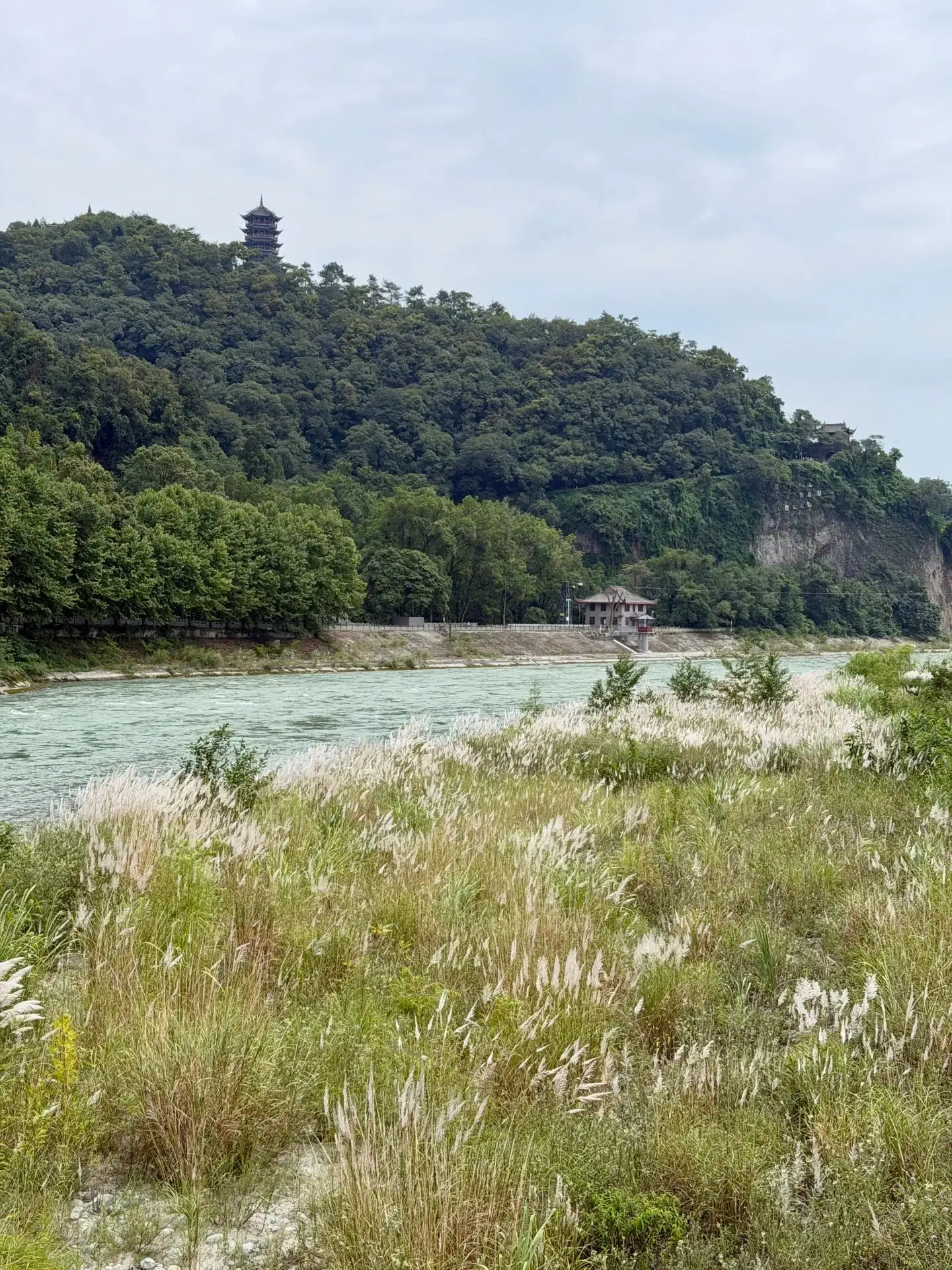
Dujiangyan can be a day trip from Chengdu or an overnight stay combined with confirmed nearby mountain or cultural interests. Its subject is more than a scenic riverbank: the irrigation system remains connected with water use on the Chengdu Plain. First understand where the water comes from, how it is divided and where it goes, then follow open routes to observe actual flow. International visitors benefit from a guide who can explain key structures clearly rather than simply naming them in Chinese. Riverbank buildings, slopes and public spaces are also worthwhile, but a town walk should complement, rather than stand in for, the irrigation visit.
Yuzui, Feishayan and Baopingkou provide key references for understanding Dujiangyan. Use a diagram to establish their relationship, then match its directions to the site. Diversion, rock openings and surface movement make more sense as parts of a working system than isolated sights. One attractive photograph cannot explain all functions. Use formal sources and knowledgeable guiding for chronology, maintenance and engineering rather than filling gaps with legends. The matched river, building and hillside photographs here are observation prompts, not comprehensive views of every structure. Entrances and viewing routes still need checking.
At permitted river-side positions, begin with the overall direction, then examine nearby ripples, stone banks and higher slopes. Water levels, weather and management alter the day's appearance; neither clear nor rushing water in a photograph is a daily promise. Leave guiding time for engineering interests, or add riverbank observation for landscape interests, both within open routes. Do not cross barriers for a closer frame or treat slippery banks as ordinary footpaths. Differences in sound, colour and movement help explain water, without turning a normal visit into a dramatic adventure. Actual path conditions matter more.
For a Chengdu day trip, make the irrigation system the main subject, then allow a meal or nearby town walk according to transport and energy. Do not assume several mountain areas fit too. A Qingcheng Mountain visit needs separate checks of the chosen area, walking and travel, often with another time slot or overnight stay. Sharing a World Heritage name does not make the two one entrance or simple circuit. An evening urban riverbank walk can be relaxing, but illumination and events vary. Overnight guests can separate water interpretation from the following day's theme; day visitors can retain depth by choosing less.
Match train or road arrivals with the actual entrance, confirming station, pickup, return and luggage arrangements before ordering the visit. Similarly named urban stops are not automatically interchangeable, and traffic and peak crowds affect timing. With children, walking aids or a wish to reduce steps, check individual open paths rather than using a vague easy-visit label. Choose lodging for quietness, transfers and dining convenience; a river-side room also needs checks of nighttime conditions and sound insulation. Local meals can complement the town visit, with ingredients, spice and allergies clarified. No unchecked standard prices or services are quoted.
Season and water conditions change the view. Warmer dates need allowance for sun and rain, cooler dates for layers; use actual trip dates and scenic information. Paving may be slippery after rain. Follow river-side management notices and retain the main interpretation if routes change, rather than adding unknown side trips. This remains functioning water-management heritage, and visitor access covers authorised areas rather than all engineering spaces. No fixed water volume, empty view or particular weather is promised. A useful visit connects the diagram, real river and city's position in memory, beyond collecting every structure's name.
Use Yuzui, Feishayan and Baopingkou as connected reference points, beginning with a diagram before observing the water. An explanation of how the parts cooperate links names, positions and functions.
Dujiangyan connects mountain water with irrigation on the plain. Looking at changing terrain and the direction of flow makes that geographic relationship tangible beyond a photograph of one structure.
Follow the guided visit with a meal and a nearby street walk, moving from concentrated interpretation to a relaxed city stop. An overnight stay gives room for a different surrounding theme the next day.
Follow the open riverbank to establish the direction of flow, then notice nearby ripples, vegetation and tree shadows. Plants give the broad water a foreground reference, while changing colours suggest distance. Continue with the question of how this water reaches the Chengdu Plain, linking the view to the irrigation system.

Take in the shoreline, wooded slopes and buildings together, noticing how higher structures face the river. A change of position makes the relationship between slope and water clearer. After an engineering explanation, this view adds real terrain to the directions shown on a diagram.

Near Baopingkou, use an on-site diagram to locate yourself before observing the water through the opening. Look at where the rock face meets the flow, turning the name into a recognisable space. With guiding, connect this view to upstream division and downstream use to understand the wider system.
Arrive from Chengdu → understand the irrigation system through diagrams and guiding → observe the river → dine and walk nearby. Reserve a separate visit segment for Mount Qingcheng or another theme.
Begin with a diagram of the main structures, then follow an open route with interpretation of flow and terrain. Keep the focus on understanding the system before a nearby meal. A full day allows a further riverside and street walk.
Give the first day to the irrigation works and city riverbanks, returning to your accommodation after a meal. On the second day, visit a confirmed area of Mount Qingcheng or extend the city stop according to your interests before continuing your Chengdu journey.
Once return transport is chosen, confirm the station, scenic entrance and pickup point. For Mount Qingcheng, check the selected area and walking conditions separately, allowing another visit segment or an overnight stay.
Check weather and scenic information before leaving, and wear shoes with grip after rain. Observe from open paths; if steps need to be reduced or mobility aids are used, discuss the specific route and rest places in advance.
Arrange your guiding language if engineering is a priority and allow time to match diagrams with the scene. Leave a break between the visit and return journey, checking nighttime noise and insulation for riverside lodging.

Start with your interests, available time and the right combination of places.

Plan by region and interest, rather than choosing one season for the whole country.

Meet local life with curiosity, consideration and an open mind.
YOUR JOURNEY
Share the places and timing you have in mind, then discuss a suitable route with a guide or travel adviser. Services and availability need confirmation.
Contact a guide about this place
FROM INSPIRATION TO YOUR JOURNEY
A place you dream of. A journey shaped around you.
Plan my trip