Dongxing Travel Editorial Department · Travel Diaries and Pre-trip Reading
Decide on your return route first, then figure out which peak to climb
The first decision you need to make for a Mount Hua trip is how to descend. A round-trip on the West Peak cable car allows you to focus your activities on West Peak and the surrounding areas; ascending via West Peak and descending via North Peak, however, requires you to factor in both the hike between the two peaks and the transportation to and from the mountain. Although route names consist of only a few characters, they can significantly alter how you allocate your energy throughout the day. If you take the high-speed rail from Xi’an to Huashan North Station, you’ll also need to factor in the transfers from the station to the visitor center and from the visitor center to the cable car entrance—don’t assume that arriving at the station means you’ve already reached the mountain. Before setting out, carefully review the official trail map to confirm the locations of the cable car stations and shuttle bus stops. Then narrow down your options based on your companions’ knee condition, fear of heights, and walking preferences. Selecting just one or two main peaks is sufficient to experience the mountain’s rugged beauty. The clearer your route is, the easier it will be to calmly decide whether to continue or turn back when you reach a fork in the trail—rather than following the crowd along a long route you weren’t prepared for.
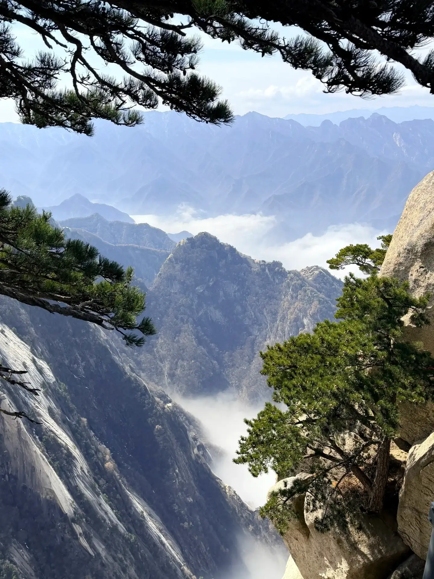
Mist between the Mount Hua pines and the rock face.
the cable car ascending, the mountain doesn’t get any easier
The cable car carries visitors over a considerable distance of elevation gain, but the steps, undulations, and exposed rock faces on the mountain remain. Looking out the window from the cabin, you can first make out the vertical textures on the rock faces, the clouds gathering in the valley, and the crevices where the pine trees take root. Upon arrival, don’t rush to catch up with the group ahead; take a moment to get organized, place your clothes and water where they’re easy to reach, and then set off on the actual mountain trail. The temperature, wind, and how your body feels may differ from what you’re used to at the base of the mountain, so it’s not advisable to wear thin-soled shoes chosen on the fly in the city. The view from beside the cable car already provides a clear impression of the mountain; there’s no need to tackle every steep and perilous section just to prove you’ve climbed Mount Hua. If clouds or mist drift over the rock faces, the peaks may temporarily vanish, but you can still observe the nearby rocks and trees. Waiting a few minutes can sometimes open up new views, but the weather won’t change to fit your photography plans—it’s more practical to allow extra time for the return trip early on.
the rocks of West Peak from the cabin—it’s a great spot to pause and read
as you approach the West Peak area, the mountain’s silhouette—which had been a distant, rolling range—transforms into massive blocks of grayish-white rock right before your eyes. Some slopes are smooth and steep, yet pine trees and low-growing plants cling to the crevices; the hard rock and these tiny forms of life create a striking contrast. At wider spots where stopping is permitted, you can observe how the steps follow the contours of the rock face as they ascend, how the handrails and iron chains aid in walking, and how hikers slow their pace as the slope changes. The story of splitting the mountain to save one’s mother offers a clue to understanding the cultural memory of West Peak, but myth need not replace the topography. After hearing the story, return to the actual rock face—the mountain’s shape and the interpretations people have ascribed to it can coexist. When taking photos, there’s no need to stray from the path in search of more dramatic vantage points; simply standing along the standard trail and capturing one element—be it a stone step, a rock face, or a pine tree—is often enough to convey the character of this mountain path.
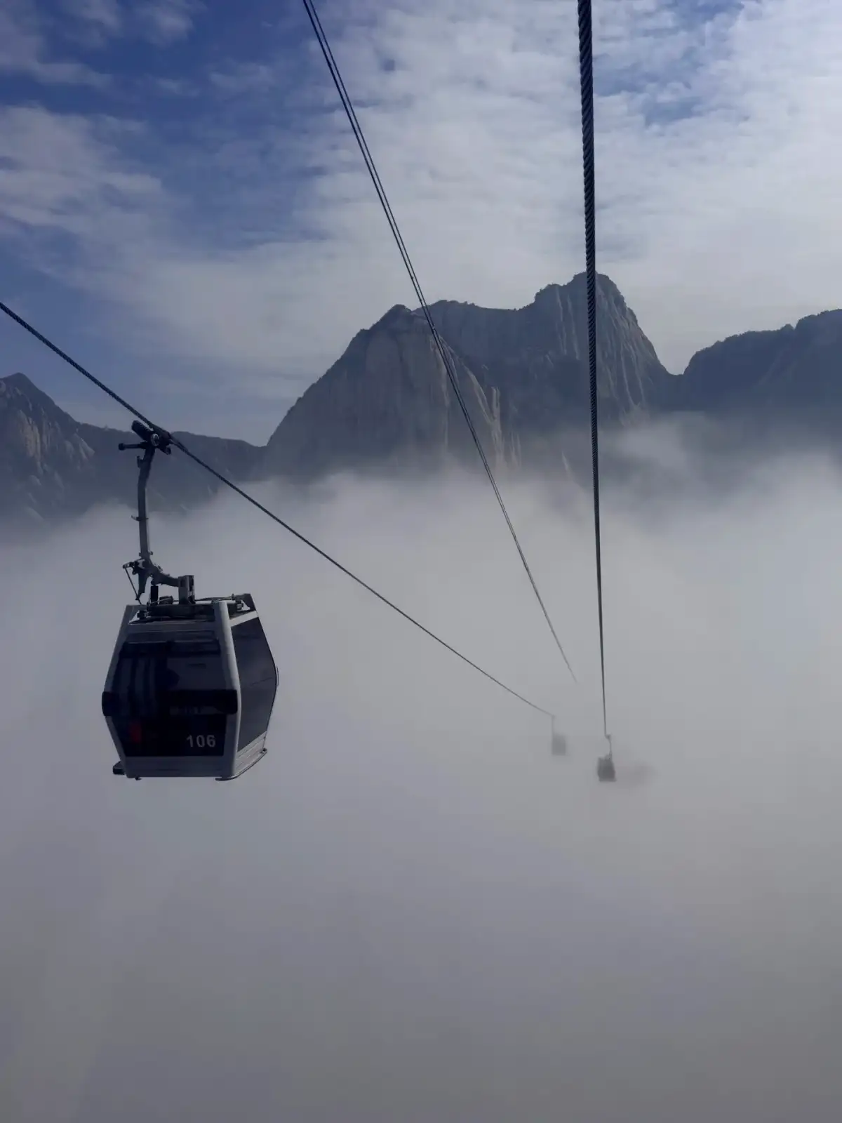
A Mount Hua cable car cabin passes through the clouds in the mountains.
the ridges—you’ll have to count them twice when hiking
If you plan to continue from West Peak toward South Peak, East Peak, or Central Peak, it’s best to check your time and stamina again at the first major junction. Peaks that appear adjacent on the map may require a descent followed by an ascent along the trail, and the distance traveled must be calculated together with the distance back to the descent cable car. For those whose knees tire easily, descending stairs continuously may not be any easier than climbing them. It’s advisable to break longer routes down into several decision points rather than committing to conquering all the peaks from the start. For the route to North Peak in particular, you should familiarize yourself in advance with the actual path, open sections, and required walking distance—don’t assume it’s suitable just because you’ve heard it’s “mostly downhill.” When you reach a fork in the trail, check the directional signs and official maps to confirm the direction of the cable car station. Knowing exactly which end you’ll descend from can prevent you from realizing too late in the evening that you’ve wandered to the wrong side. The ridgelines of Mount Hua are truly captivating, and a well-planned route should leave you with enough energy to appreciate them.
the sea of clouds from the cabin is breathtaking, though it can also obscure the path
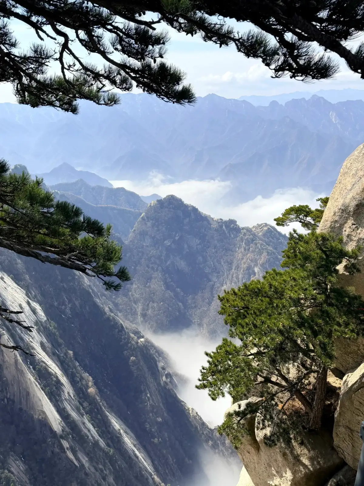
the clouds gathering in the valley, the rocky peaks emerge like islands from the white expanse; a gust of wind would separate peaks that were once connected. Such scenes easily make one anticipate the next change, but when standing on the ridge, one’s gaze shouldn’t be fixed solely on the distance. As the mist thickens, pay closer attention to the edges of the steps, damp patches on the ground, and the hikers ahead—and avoid stopping in narrow spots to rummage for your camera. The appearance of a sea of clouds depends on temperature, humidity, and weather conditions; you may not encounter it on every visit. On sunny days, you can see the terrain more clearly, while on cloudy days, you can observe the interplay of light and shadow between rock faces and forests—each offers its own unique subjects for observation. If the distant view is completely obscured, shorten your stay and proceed along a confirmed route or head back. The beautiful sea of clouds in the photo captures the mountain at a specific moment; it does not indicate that visibility was the same along every section of the trail that day. If you approach the hike with this understanding, changing weather conditions will become a natural part of your journey.
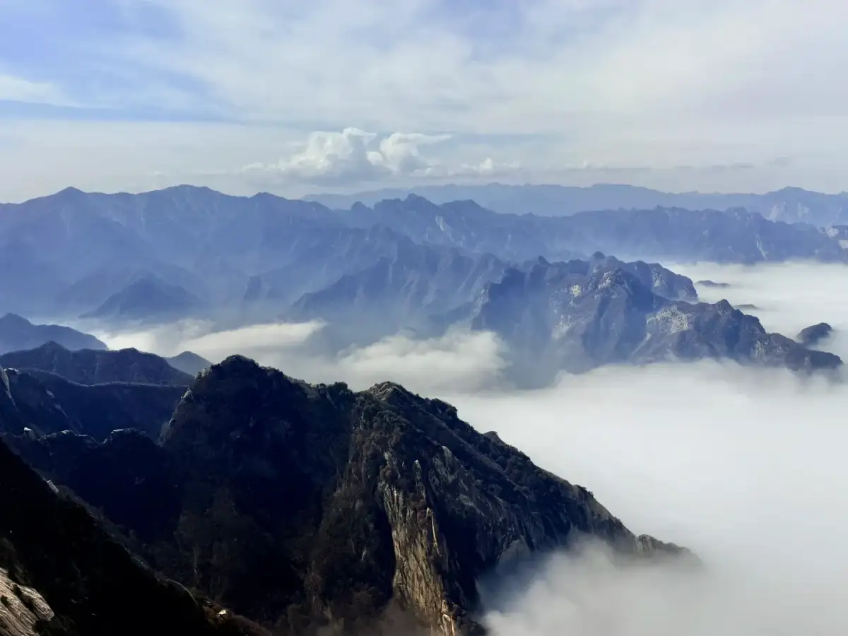
the peaks of Mount Hua and the sea of clouds in the valley.
The fame of these treacherous sections doesn’t have to turn into a chore
Mount Hua has several sections renowned for their rugged terrain; these differ significantly from the preparation, accessibility, and perceived risk associated with standard hiking trails. When planning your itinerary, first familiarize yourself with the standard route before assessing whether you’re suited for any additional experiences. For activities requiring specific gear, separate queues, or staff guidance, follow the on-site instructions. If a fellow traveler is reluctant to participate, do not interpret their hesitation as a lack of courage. Appreciating the mountain can happen beside the cable car, at a spacious viewing platform, or even on a ordinary flight of stone steps—there is no need to use the most nerve-wracking spots as the sole criterion for evaluating the journey. The same applies to photography: climbing over railings, backing up to the edge, or posing on steep slopes does nothing to deepen your understanding of the mountains. Simply stopping at a stable spot, listening to the wind rustling through the pine trees, and watching the clouds cover and then reveal a stretch of rocky peaks is, in itself, a complete mountain experience.
Set aside a separate plan for the sunrise
the sunrise at Mount Hua is famous, but waiting for dawn on the mountain requires more meticulous preparation than a day trip. First, verify the areas where overnight stays are permitted, the night hiking schedule, the weather, and your descent plan for the next day before deciding if it’s feasible. Don’t combine arriving at the station in the early morning, a night hike, watching the sunrise, and rushing to catch the first return cable car into an itinerary with almost no sleep. The cold and wind on the mountain make a long wait more grueling than continuous walking, so your clothing and rest arrangements should differ from those for a daytime trip. If you have several days of mountain hiking experience, you can plan carefully based on your own condition; if this is your first time at Mount Hua, taking the cable car during the day and enjoying the mountain views when the weather is suitable won’t mean you miss out on much of the scenery. You can appreciate the orientation of East Peak and the culture surrounding sunrise during the day, and the morning light may be obscured by thick clouds. Exhausting all your energy for a moment that isn’t guaranteed will often detract from the truly clear and visible scenery that follows.
Spring, summer, and winter each have their own pros and cons
spring and fall often evokes images of comfortable hiking, but mountain weather can still change rapidly. Before setting out, check the forecast for the mountain itself—not just for downtown Xi’an. In summer, be prepared for thunderstorms, intense sunlight, and holiday crowds. Setting out early gives you more flexibility in your schedule, but it doesn’t guarantee you’ll avoid lines. In winter, ice and snow alter the traction on the stone steps and affect the accessibility of certain sections; footwear and gear must meet the day’s requirements—do not rely solely on clear skies in photos to judge ground conditions. During rain or strong winds, respect any temporary adjustments made by the scenic area and the cable car operators; you should also keep the option open to switch your original itinerary to activities at the base of the mountain or sightseeing within Xi’an. For international visitors, admission tickets, mountain transportation, and different cable car options may need to be confirmed separately; the identification documents used for reservations must match those you actually carry. Double-checking all details in advance will save you a lot of hassle compared to trying to figure out your package details on the spot, and it will allow you to focus your attention on the trails while on the mountain.
After descending, looking back at the path we’d taken
Upon reaching the base of the mountain, Mount Hua’s silhouette reassembles from the nearby rock face into a range of peaks. At this point, looking back at the route map and marking the path you’ve actually walked often helps you understand why the deep valleys seen from the cable car that morning appeared so steep—and reveals that you’ve only experienced a small fraction of the entire mountain. Travel photos can be arranged according to the progression of the hike: the rock faces drawing closer during the ascent, the twists and turns of the path between the peaks, the clouds moving across the valley floor, and finally the return to the foot of the mountain. This sequence more closely mirrors the actual experience than listing all the peak names as a checklist. Not having reached a particular peak does not prevent one from remembering the pine trees and stone steps at another location. What makes the scenery of Mount Hua so unforgettable is not only the jagged cliffs and lofty ridges, but also the fact that one must constantly make concrete choices while navigating them. When you factor in the time needed to descend, your stamina, and the weather into these decisions, the very flexibility of those choices becomes the most reliable reward of the day.
Further Reading and References
Compiled and organized by the Dongxing Travel Editorial Department based on publicly available travel notes and listed information. Intended for pre-trip reading; this is not a personal account of the experience. Please verify opening hours, transportation, reservations, and service arrangements according to your actual travel dates.
Shaanxi Taihua Tourism Cableway & Highway Co., Ltd.: Mount Hua West Up, West Down Route
Does taking the cable car make the whole visit easy?
A Huashan West Peak route includes more than the ascent. Huashan cable-car walking still needs a clear account of steps, ridges and the way back. If rock faces and pines interest you, explore fewer places slowly rather than treating famous exposed sections as compulsory. Confirm a route suited to your companions before adding movement between peaks.
When should clouds and sunrise become separate plans?
Set a Huashan descent plan around available options and time margins before waiting for changing cloud scenery. When cloud obscures the view, avoid moving towards edges or adding unconfirmed paths to chase light. Sunrise requires a different departure and accommodation rhythm; plan it separately rather than extending a daytime West Peak walk into a tiring night journey.
Planning references