Dongxing Travel Editorial Department · Travel Diaries and Pre-trip Reading
Start by standing on the bank, listening to the water before examining the dam
Yuliang Dam is best observed during your first stop on the shore. From a distance, the dam resembles a stone line spanning the Lianjiang River; only when you reach a safe vantage point will you notice the difference in water level between the upstream and downstream sections. As water levels vary, so do the sounds, the exposed stone slabs, and the color of the water; don’t base your decision on whether it’s worth visiting that day by relying on a promotional photo showing abundant water flow. Understanding the dam begins with observing the on-site conditions.
If you’re spending half a day in Shexian, combine a visit to the Ancient Yuliang Street, the riverbank views of the ancient dam, and a riverside walk. While there are transportation links to the Ancient City of Huizhou, plan your route based on actual entry points and your accommodation location; avoid treating the two areas as a single, continuous commercial street. Upon arrival, read the guidebook and management notices first to confirm which sections of the riverbank are accessible and whether there are any restoration barriers. Recent cultural heritage restoration updates remind visitors that the ancient dam is an engineering heritage site undergoing ongoing maintenance, so on-site access may be subject to change; the selection of viewing spots should follow current management guidelines.
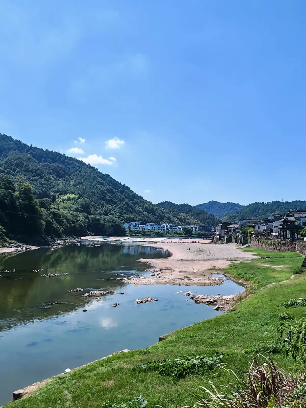
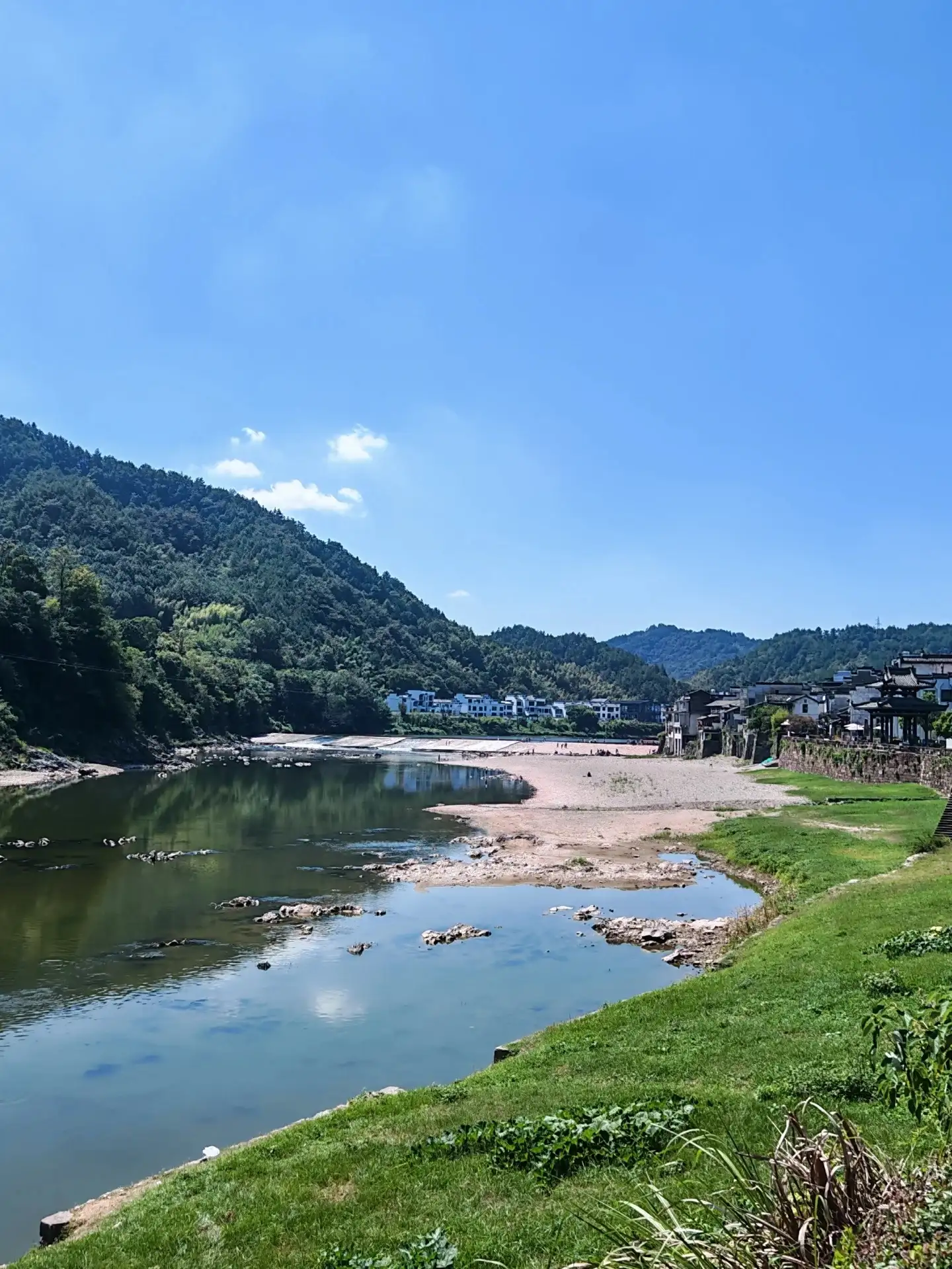
The Lianjiang River Fishweir Dam and the mountainous shoreline.
Upstream and downstream: the distinct water surfaces are worth examining separately
When observing the ancient dam, it is recommended to divide your viewing into two parts: the upstream and the downstream sections. Upstream, the relatively smooth water surface and the edge of the dam form a distinct boundary, while downstream, the drop in elevation is revealed through the flow of water, white spray, or exposed rocks. When water levels are low, more of the dam structure and riverbed become visible; when water levels are high, the force of the water is more readily felt. Each condition offers different insights—there’s no need to wait solely for the so-called most spectacular waterfall formations.
Once you’ve found your footing, observe how the water flows around the rocks, where it cascades down, and how it converges again into the river below. This is a visual exploration of the engineering—it cannot be achieved by wading into the water or stepping on wet rocks. Even if the shore and dam surface appear dry, you must adhere to access regulations; slipperiness and water level changes cannot always be accurately judged by appearance alone. If the site allows you to climb onto the dam, first assess the accessibility and safety conditions before deciding whether it is suitable for your companions; if it is not, you can still fully understand the relationship between the upstream and downstream sections while remaining on the bank. The value of observing an ancient dam is not diminished simply because you do not set foot on it.
The connection between the stone blocks is more critical than a single stone
Official materials from Huangshan describe the ancient dam as constructed with dressed stone blocks, while conservation records also mention techniques such as dovetail joints and stone tenon-and-mortise fastenings. By turning your gaze to the visible surface of the dam—where it is safe to look—you can examine the joints and the arrangement of the dressed stone blocks, and consider how the stones collectively withstand the force of the water. The stability of the structure stems not only from its weight but also from its interconnections and structural arrangement—a fact that elevates the ancient dam beyond the image of a mere massive stone wall.
Small structural components may not be clearly visible from the visitor viewing platform; visitors can rely on display diagrams, informational signs, or guided tours to understand them—there is no need to walk to the edge of the construction site just to see the stone locks. When reading the restoration descriptions, distinguish between preserved old stones, newly added components, and sections currently under treatment. Conservation work is not merely a static presentation of a heritage site after it has ceased to be used, but rather ongoing care based on an understanding of materials, craftsmanship, and water flow. For international visitors interested in technology, focus the discussion on connection methods and maintenance; even without a comprehensive understanding of China’s history of water conservancy, they can still gain insight into the specific ingenuity applied here.
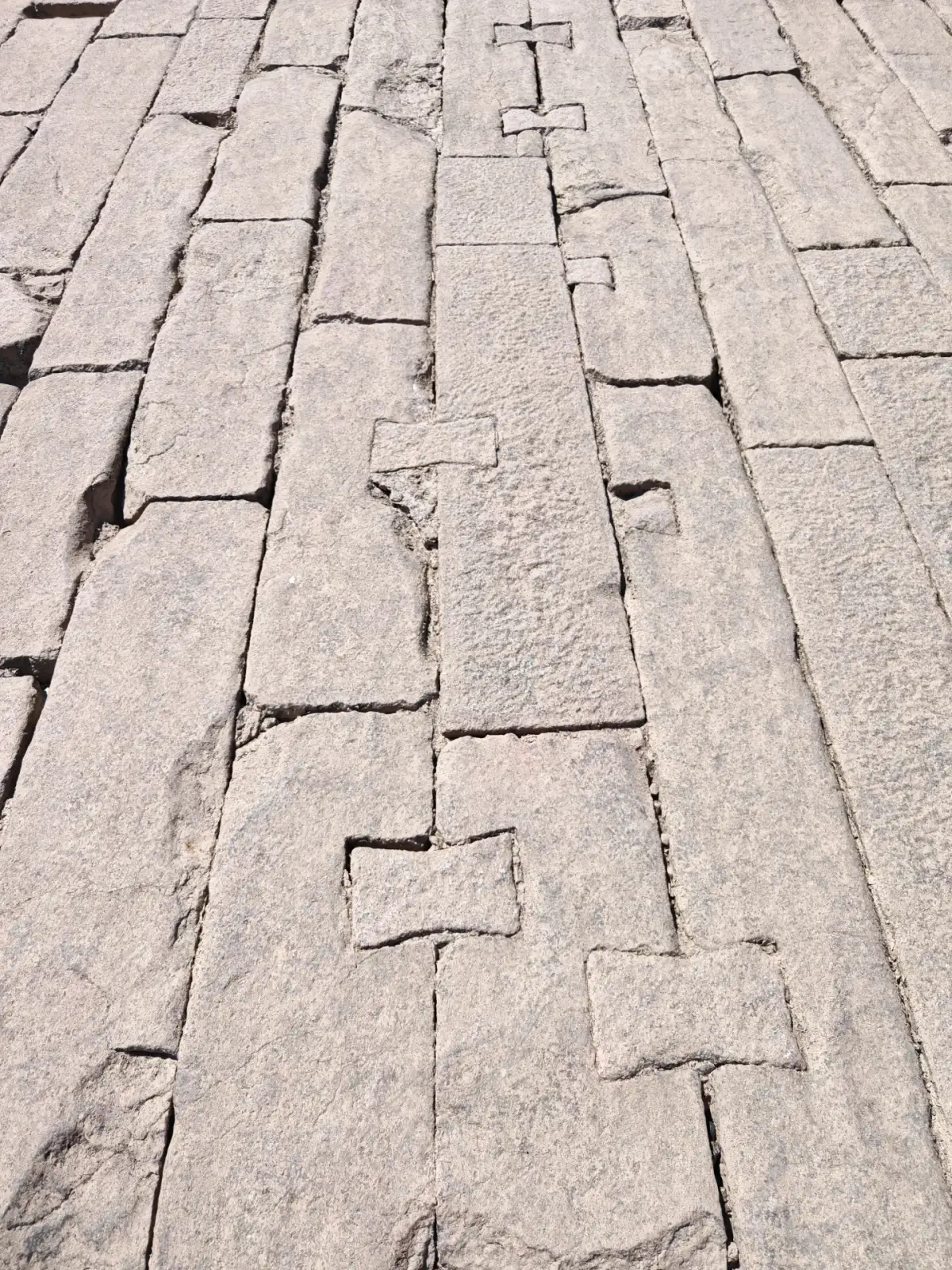
The stone blocks of the Yuliang Dam and their dovetail-shaped joints.
Walking along the old street, the pebbles underfoot also have a rhythm
Returning from the dam to the Ancient Yuliang Street, the sound of water gradually fades as it is enveloped by the street’s buildings, while the path beneath your feet redirects your attention to the immediate surroundings. The street is best explored at a leisurely pace, taking time to observe how the pebbles, doorsteps, eaves, and storefronts come together—don’t treat this place merely as a passageway on your way to the next attraction. Huangshan City’s introduction to its ancient streets links Yuliang to the Huizhou merchants, and the buildings along the street and the riverside path provide just the right clues for observation.
The Old Street is not a vacant scene reserved solely for photography; residents, shops, and visitors all use it. When stopping in narrow sections, step to the side to allow strollers and fellow pedestrians to pass; if you see an attractive doorway, first confirm whether it is a residential entrance. The traction on the gravel road may differ after rain compared to when it’s dry; wear shoes suitable for walking, and leave large luggage at your lodging or a designated storage area. Uneven surfaces can also make it difficult to maneuver strollers or wheelchairs; those with mobility needs should inquire about accessibility in advance and shorten their daily route to a distance that can be safely covered.
Narrow alleys face the river, and the outline of the old river port comes into view
Within the publicly accessible area, take a short walk down a narrow alley extending from the street toward the riverbank to understand that the street and the water are not two separate attractions. Street life requires roads, while water transport brings goods and people to the shore; the two are connected through gates, alley entrances, and steps. Although the full picture of the bustling activity of the past is no longer visible today, this spatial relationship still helps us understand the organizational structure of the old river port.
When you reach the stone steps leading down to the river, observe the dam’s width and bends from above—there’s no need to rush down to the end. Not every section of the riverbank is suitable for continuous walking; some paths end at a gate or pier, so plan your route in advance and return the way you came if a path is blocked. The historical functions of a particular merchant house or loading/unloading site must be understood based on the local exhibits; one cannot infer a merchant’s wealth solely from the size of the facade. A single round trip along the historic street and riverside path leaves a more lasting impression than a string of unconfirmed stories: when transportation depended on rivers, the orientation of buildings and the exits of alleys held very practical significance.
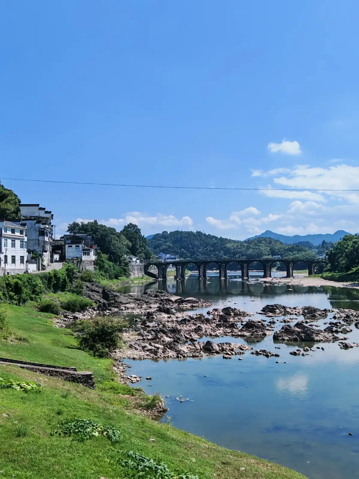
The Lianjiang Riverbank at Yuliang and the stone bridge.
Take a moment to pause and observe the changing flow of the water
If you find a public area where you’re allowed to linger, sit down or stand to the side for a moment—don’t rush to take your photos and leave. While the water’s flow up close is constantly shifting, the outlines of distant mountains, bridges, or houses remain relatively stable; within just a few minutes, you’ll notice the coexistence of movement and stillness. Watching a patch of white spray form and then disperse, or observing the movement of the waterline alongside a crevice in the rocks, transforms the dam from a historical term into a structure that continues to coexist with the river.
You can also plan to stop for a meal at a restaurant with a clear menu; first confirm the pricing and seating arrangements, then decide whether to dine by the river. Shexian’s cuisine is linked to Huizhou culinary traditions, but there’s no need to try to sample everything in the county in a single meal. Start by selecting one or two dishes based on the number of people, dietary restrictions, and energy levels, and set aside some time to drink water and rest; if you have allergies or dietary restrictions, specify the ingredients in advance. After the meal, if you’re still feeling energetic, return to the riverbank to view the dam in different lighting conditions; if you need to return to the county seat, end your visit here—don’t let waiting for the sunset turn your transportation arrangements into a last-minute scramble to find a ride.
Water levels, restoration efforts, and rainy weather must all be taken into account
Since the Yuliang Dam is closely tied to the water, planning your visit should not rely solely on whether the sun is shining. Prolonged rainfall, inflows from upstream, and on-site water management operations can all affect river conditions; visitors should follow official announcements and local management guidelines. When the water level is high, do not chase the waves toward the dam’s edge; when the water level is low, do not assume that the exposed riverbed is an area where you can walk freely. While the temperature and light may be pleasant in the early morning and evening, this does not automatically mean that conditions are safe for passage.
In spring and autumn, allow more time to explore the riverside path and the historic street; in summer, minimize prolonged stays in unshaded areas; and in winter, be mindful of the river breeze and the damp, cold weather. During light rain, shorten your outdoor observation and focus on the historic street, informational displays, and open exhibitions; in the event of heavy rain or weather warnings, adjust your plans accordingly. Reservations, ticketing, and accessible areas: Check current information through official channels before departure; during renovations, follow on-site barriers as the final guide. For families with children, select a viewing spot first, then let the children observe the water flow to avoid having to chase after them while searching for safe boundaries.
Only upon returning to Shexian from Yuliang do the memories of the river and its ports truly come together
After half a day, upon returning to Shexian, you can contextualize the ancient dam alongside the merchant residences, streets, and Huizhou culture you’ll encounter later. Water transport is not merely a story of old boats; it influences how a settlement lays out its roads, stores goods, and connects with the outside world. The dam, river, and streets left behind by the fishing weir provide concrete clues that help a first-time visitor to southern Anhui understand the geographical conditions of the Huizhou merchants’ lives.
On your return trip, verify the actual pickup location; in particular, do not send the riverside location directly to the driver as a parking address. Save the Chinese names of your accommodations and the bus station in advance, and allow enough time to walk from the old town to the main road. The photos you take can each answer a different question: how the dam spans the river, how the stone slabs are arranged, and how the streets unfold toward the water. When revisiting these images, even if there was no brilliant sunset that day, you’ll still be able to recognize what you truly absorbed during that half-day. The value of a river port lies in the enduring connections between water, engineering, and settlements—connections worth exploring slowly from the safety of the shore.
Further Reading and References
Compiled and organized by the Dongxing Travel Editorial Department based on publicly available travel notes and listed information. Intended for pre-trip reading; this is not a personal account of a visit. Please verify opening hours, transportation, reservations, and service arrangements based on your actual travel dates.
Huangshan City: Yuliang Street
Huangshan City: Progress on the Yuliang Dam Restoration
Must you stand on the dam to understand it?
A Yuliang Dam visit can begin on the bank, comparing upstream and downstream surfaces and how stone blocks connect. Yuliang Dam stonework observation concerns the relationship of stone and water, rather than approaching strong currents for photographs. If water levels, repairs or rain change access, remain on open routes; a view from shore still supports a focused inquiry.
Connecting the dam with the old street
Use a Yuliang old-street walk to follow a public lane towards the river, comparing street height, steps and the water's edge before looking back towards the dam. The former port includes life on shore as well as engineering. With little time, choose one lane and one bank-side viewpoint, reducing repeated crossings and protecting the journey back to Shexian.
Planning references
Planning reference: Yuliang Dam visit 1