East Travel Editorial Department · Travel Diaries and Pre-trip Reading
Before entering the site, look for the terraces and the river valley
Jiaohe Ancient City is not an ancient town that still retains its complete streetscape; rather, it is a place where one must discern the city from the ruins. Situated on a plateau on the outskirts of Turpan and flanked by river valleys on both sides, the relationship between the topography and the site’s location serves as a crucial starting point for the visit. Upon reaching the entrance, start by examining the site map to identify the north-south orientation, the main roads, and the areas open to the public that day, then follow the designated visitor route. Even if you are unfamiliar with the history of the Chashi, Gaochang, or the Tang Dynasty’s Western Regions, you can still grasp one simple fact: the ruined walls before you once belonged to a city where people lived, governed, and carried out their daily activities. Do not assume that every earthen slope is a vantage point you can climb; be sure to clearly identify the designated paths and protected areas right from the start. The shape of the plateau, the surrounding river valleys, and the internal architectural layout collectively explain why this site became a city—and it is here that the landscape and history begin to intertwine.
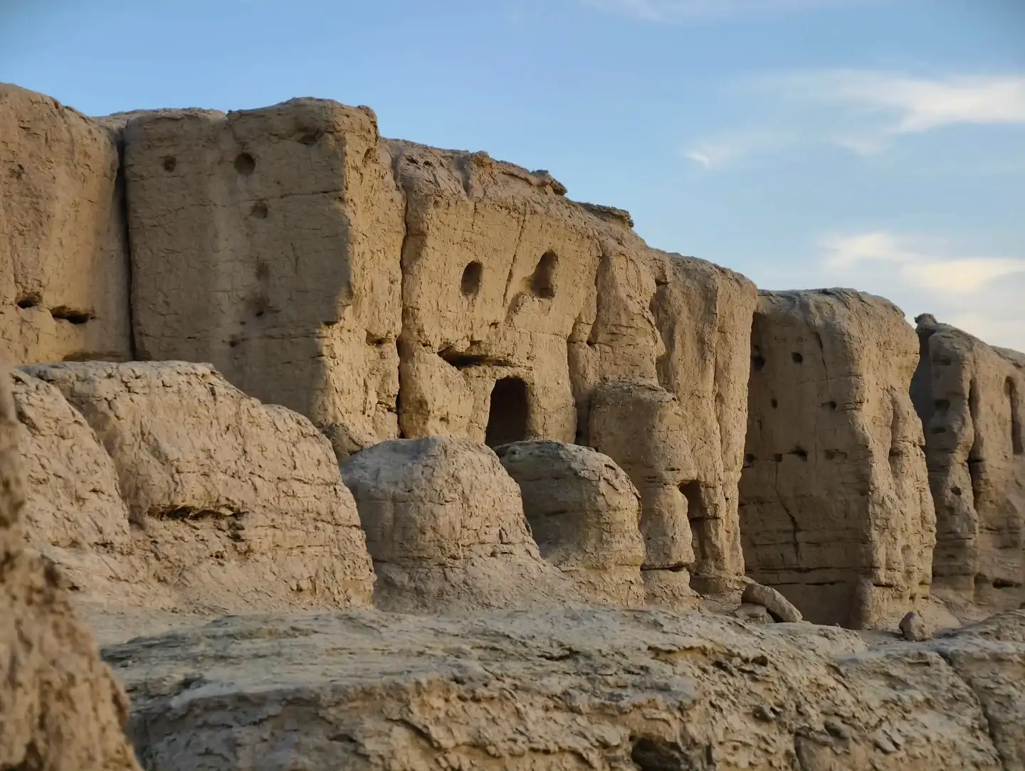
Raw earth walls and surviving openings at the Jiaohe Ancient City.
Walking Along the Main Path, Interpreting the Gaps as Streets and Alleys
Once inside the ruins, the walls are the most obvious features, but what truly requires patience to discern are often the gaps between them. As you proceed along the main visitor path, observe how the structures on either side define a passageway—noting where it narrows and where open spaces emerge. The visitor paths laid out today serve the purposes of sightseeing and preservation; they should not be directly equated with the original ancient road surfaces, but they do help visitors observe the remains from appropriate vantage points. When encountering fragmented spaces, you can use on-site signage to understand the layout of streets, alleys, houses, and functional zones, avoiding the mistake of assuming a structure’s purpose based solely on a square outline. After walking a short distance, stop at a designated viewing point and look back; the scattered earthen walls you just passed may coalesce into a more continuous urban fabric. This is the allure of Jiaohe: even without roofs or intact doors and windows, the human eye can gradually discern how the city was once used.
Up close at the earthen walls: examine the surface before discussing their age
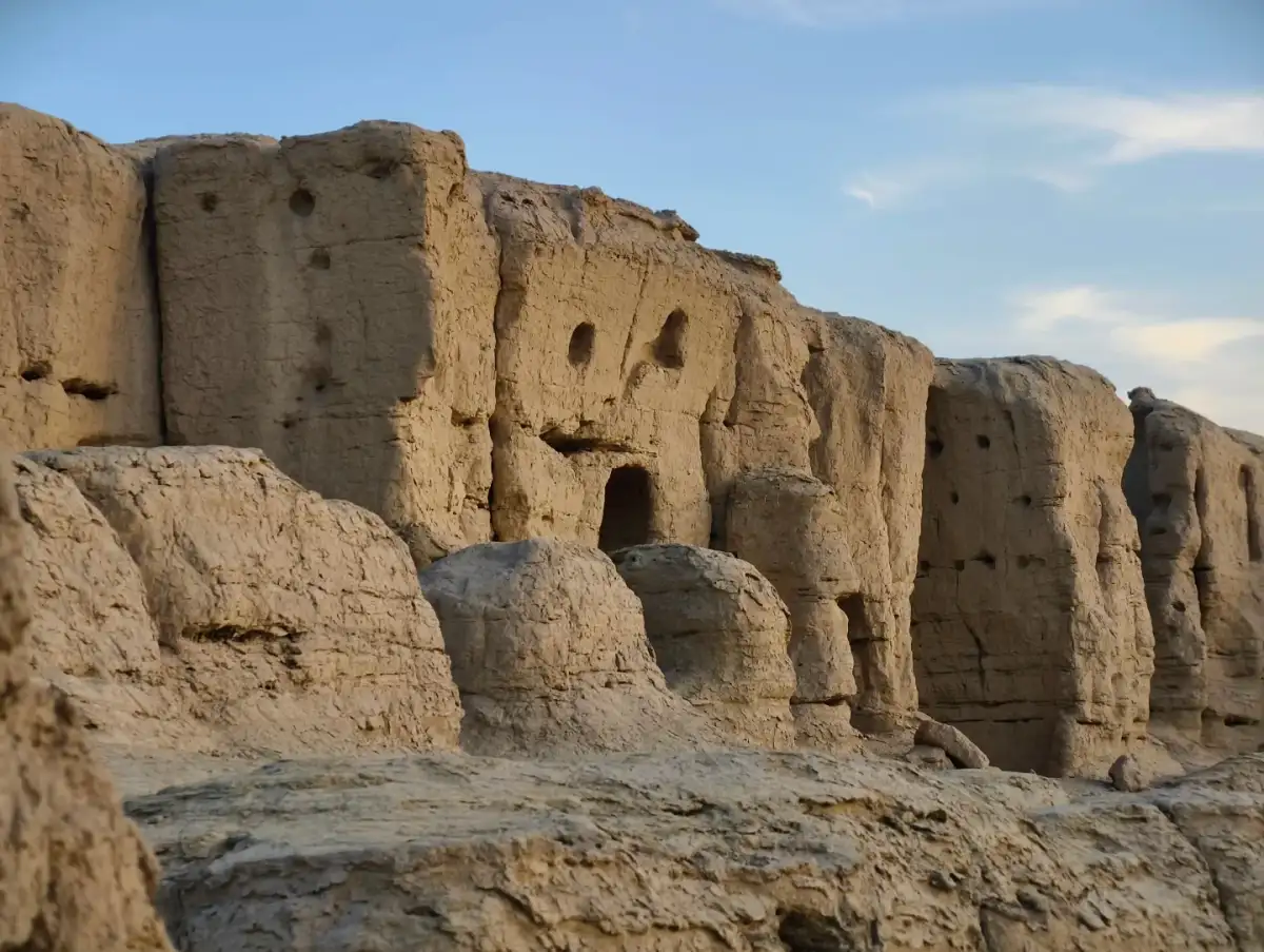
A close look at Jiaohe’s earthen walls reveals a surface marked by grains, cracks, indentations, and irregular edges; the same earthy yellow hue also exhibits varying shades of light and dark under different lighting conditions. Choose a section of wall clearly visible from the main path to observe how it changes from the base to the top, then examine how the adjacent walls connect. The construction methods, historical periods, and conservation treatments of different archaeological remains require specialized knowledge; one cannot determine their age based solely on the roughness of the wall surfaces, nor can all structures be explained by a single approach. If you see conservation measures or explanatory signs, pay attention to how erosion is controlled and fragile sections are reinforced, rather than rushing to find an angle for your photo that excludes these installations. The preservation of earthen architecture is an ongoing process; the fact that we can still discern the outlines of streets, alleys, and buildings today is due not only to historical remains but also to current conservation efforts. Using the materials as a starting point for observation brings the ruins into sharper focus.
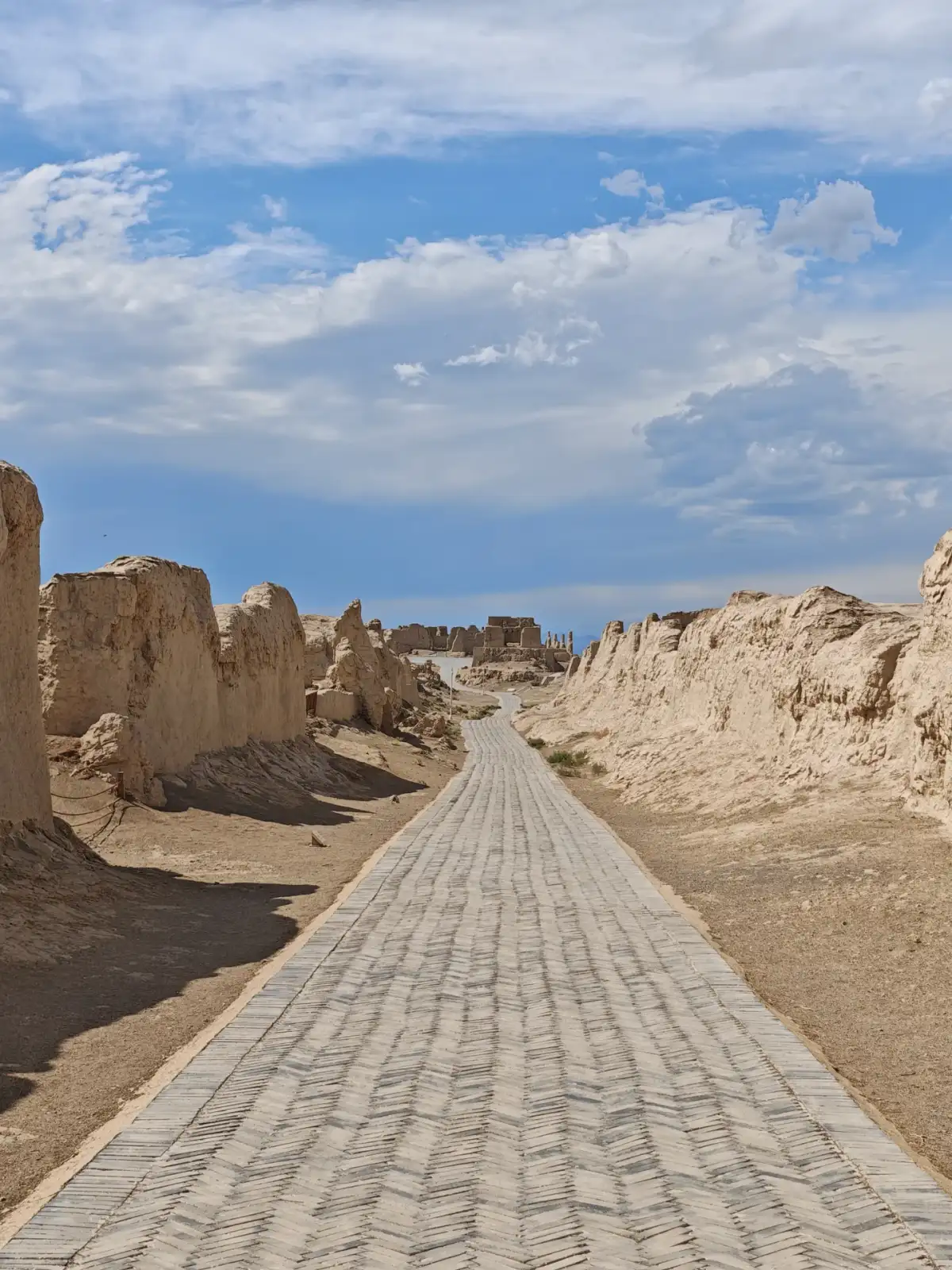
Remains of walls on both sides of the official visitor path at Jiaohe Ancient City.
—residences, government offices, and temples—which require the aid of explanatory signs
Different areas within the Jiaohe Ancient City once served distinct functions; the official tour guide will help you place the remains of residences, government offices, and monasteries within the overall layout. During your visit, there’s no need to memorize the names of all the structures at once; instead, choose a functional zone, first observe its relationship to the main path, and then examine how the courtyards and adjacent spaces are organized. When you see taller or more isolated architectural remains, don’t immediately assume they are Buddhist pagodas; first read the corresponding signs, then match the names to the actual outlines. For children visiting with you, ask questions like, “How did people here walk from the road into the rooms?” or “Which areas would have required larger gatherings?” This is far clearer than having them memorize dynasties. If a guide is available, ask how the site’s functions were determined based on artifacts or layout evidence—this will help you understand how archaeological research works. Even though the site lacks intact structures to view directly, you can gradually reconstruct the relationships of daily life through these evidence-based questions.
In open areas, observe the boundary between the city and the oasis
Upon reaching the open viewing area, you can momentarily step away from individual rooms and turn your gaze to the surroundings of the terrace. There are distinct environmental differences between the earth-toned ruins, the trees in the river valley, and the distant mountains; these differences help visitors understand the connection between the city and the oasis. Do not assume that today’s water levels and vegetation directly reflect conditions from various historical periods; river courses and the environment have also undergone changes, and specific interpretations must be based on research. The first things you’ll notice on-site are the edges of the terrace, the variations in elevation, and the distribution of green areas. Looking back at the ruins from the designated viewing points, the dense walls and gaps between streets and alleys form yet another urban landscape. The purpose of coming here is not merely to capture a panoramic view; rather, the elevated or open vantage points allow visitors to understand how the paths they have just traversed fit into the larger context. If there are railings and protective signage along the edge of the terrace, staying within the designated area allows the gaze to wander far without the need to step beyond the boundaries.
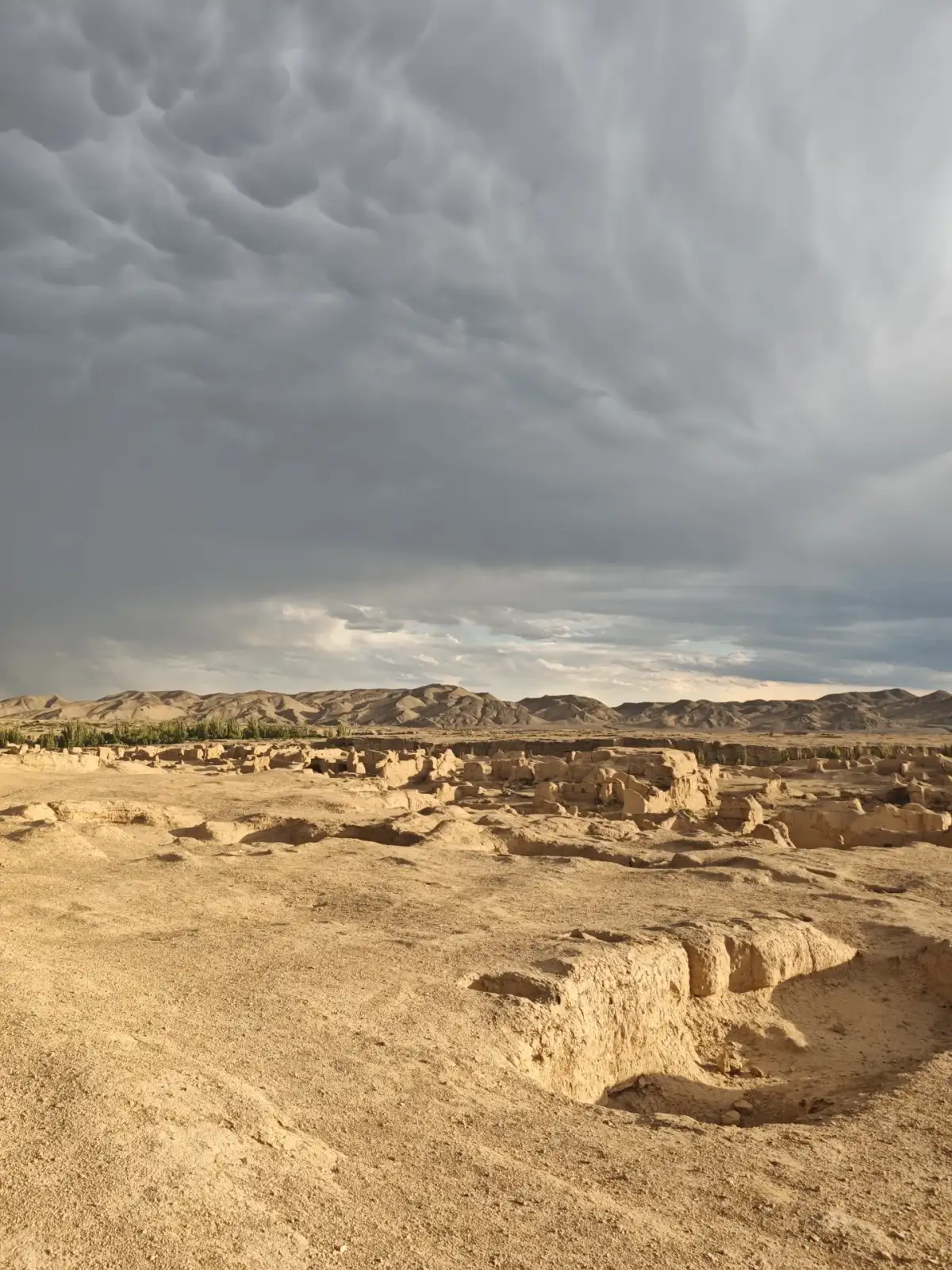
The Jiaohe Ancient City ruins as a whole, with the distant mountains in the background.
Even though the light is good in the evening, you should still plan your visit according to Beijing time
In the evenings in Turpan, the low-angle light is often ideal for observing earthen walls; the shadows make the height differences and recesses between the ruined walls appear even clearer. However, when planning your actual itinerary, you should base your schedule on the confirmed times for reservations and transportation—do not rely on your everyday impression of “evening” to estimate opening and closing times or vehicle pickup times. If you wish to enter during cooler hours, first check the day’s operating schedule, then allow enough time to complete the route and depart. Whether night tours are available, as well as the exhibition content and ticketing methods, must also be confirmed separately; do not assume that a single experience described in a blog post represents a year-round arrangement. During the day, you can examine the site’s features and topography; if there are official nighttime activities, they offer a different perspective. If you can only arrive at midday, you may shorten your walking route and focus on a few clearly visible ruins and explanatory signs—avoid exceeding your physical limits just to replicate sunset photos.
In the sweltering ruins, the quality of your stops matters more than the quantity
The open-air section of Jiaohe offers limited shade, so sunlight and ground reflection can affect your experience. When choosing footwear, water, and sunscreen, base your decisions on the actual walking time; keep your belongings as minimal as possible, ensuring your phone and water are easily accessible. You may rest before entering the park; once you reach an open rest area, assess whether to continue—don’t wait until you’re visibly exhausted to look for an exit. Companions with mobility challenges should inquire in advance about accessible routes and services available that day; do not assume that fixed shuttle services are available in all areas just because someone received assistance in a news report. During windy or sandy weather, be prepared to adjust your plans on the spot. Secure your hat and lightweight items to avoid having to chase after them while straying from the path. The weather will determine how much of the site you can see, but skipping a few areas won’t prevent you from thoroughly exploring a single street or alley. Factor your physical condition into your itinerary to help you stay focused during your visit to the ruins.
combined with the museum and the karez system, creating a rhythm for the day
A visit to Jiaohe can be combined with the museums in Turpan city or exhibitions related to karez systems to make a full day, with the focus on balancing outdoor and indoor activities. First, check the opening hours and reservation requirements for each location separately, then arrange transportation and lunch. If the names of the sites aren’t listed together, it’s assumed that all are open to walk-in visitors. If, after visiting the ruins, you wish to learn more about local history, the museum’s resources can help explain place names, historical periods, and excavated artifacts; if you’re more interested in oasis life, a formal karez exhibition can shed light on irrigation-related topics. Avoid scheduling both types of activities during the time of day when you’re most tired—clear observation requires some energy to spare. When making reservations, international visitors should confirm their passport information and available booking channels; if hiring a private car, be sure to clarify the meeting point and return time. The itinerary includes both arid plateaus and the water and urban life of the oasis. When these elements are thoughtfully connected, Jiaohe will be more than just a collection of isolated ruins.
After leaving, let the incompleteness remain a question
Looking back at photos of Jiaohe, the first things that come to mind might be the missing sections of the walls and the open spaces, but this trip can also leave you with more specific questions: How did a street extend? How were houses and public buildings distributed? How did the river valley encircle the city? How are the materials being preserved? Selecting a few photos with different content makes it easier to recall these observations than keeping dozens of similar photos of earthen walls. For further reading, start with official site descriptions and conservation materials, then gradually explore the changes in cities along the Silk Road. Avoid filling every niche with details of daily life just to make the site seem more legendary, nor should you portray the ruins as places of nothing but melancholy. Jiaohe’s incompleteness leaves room for research, allowing visitors to maintain a clear distinction between evidence and imagination. Walk along the designated paths, read the explanatory signs carefully, and then place the city back within the context of the river valley and the oasis—a short walk can open up a long history.
Further Reading and References
Xinjiang · Destination Overview
Originally compiled by the Dongxing Travel Editorial Department based on publicly available travel notes and listed information, intended for pre-trip reading and not as a personal account of the experience; opening hours, transportation, reservations, and service arrangements should be verified according to the actual travel date.
Turpan Municipal People’s Government: Bringing the Millennia-Old Ruins to Life
How can many ruined walls reveal a city?
Start a Jiaohe Ruins walk with the main route on the visitor map, then compare openings and walls from official paths. Jiaohe earthen wall observation first records height, turns and material without assigning a building's use from its outline. After finding a reliable name through site interpretation, place the detail back within the plateau and valleys to make the city more legible.
Choosing a shorter route
Use Jiaohe site interpretation to select one explained street section and one open overview position rather than covering every branch. Keep one question each for water, terrain and urban function to give walking and reading a rhythm. Shorten exposed stops in hot weather. Follow conservation instructions, never cutting between ruined walls or climbing them for photographs.
Planning references