take another photo of Yuanyang—one that might resemble an abstract painting. The water’s surface breaks the sky into small patches of blue, gray, and gold, while the ridges of the terraced fields draw a dense network of lines within it. Once you actually reach the hillside, your gaze naturally follows the colors: which patch is brighter, which direction most resembles a photo from your collection. This way of looking is captivating, but if you focus solely on color, the forests, villages, and flowing water on the mountains quietly fade from view.
小红书作者小刘同学从多依树的航拍画面谈到田地与劳动,旅行辣鸡鸟则比较多个观景台在一次出行中的光线、雾和人流。两者放在一起,提出了两个不同问题:怎样找到喜欢的画面,怎样理解这张画面为何会出现在这里。本文的观察安排由此展开,不沿用原帖的景点评分,也不把某一天的日出时刻当作固定规律。
look down from the mountaintop—the colors will reveal the relationships.
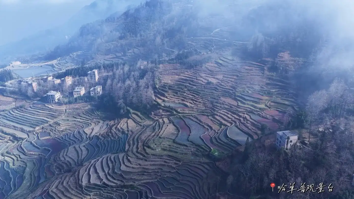
FAO’s Information on the Hani Terraced Fieldsexplain that this agricultural system connects forests, villages, terraced fields, and rivers, with water flowing from the forested areas into the irrigation network and then on to the fields. Keep this relationship in mind, and when you reach the observation deck, you’ll have new things to look for: what forested areas lie above the frame, where the village is situated relative to the fields, and how the water surfaces are divided by the ridges.
This is a way of observing that’s well-suited for family outings and documentary photography. Children can start by identifying the four types of elements, then use their fingers to trace the direction they think the water is flowing. Adults can take a wider shot of the distant landscape, capturing the forest and village, and then take a close-up of the field ridge. Placing the two photos side by side preserves the beauty of the pattern while illustrating the connection between the scenic view and the living space. If the specific function of a canal outlet isn’t explained by a local, note the question first—don’t guess its purpose based on its shape.
Introduction to the Red River Hani Terraces by the World Heritage Centeralso interpret the cultural landscape as an integrated system of forest, water, terraced fields, and houses, noting the variations in slope across different areas. The information above was verified on October 3, 2026. It helps identify observation themes but does not guarantee that every field will be at the same irrigation level on the day of your visit, nor does it replace real-time access information from the scenic area.
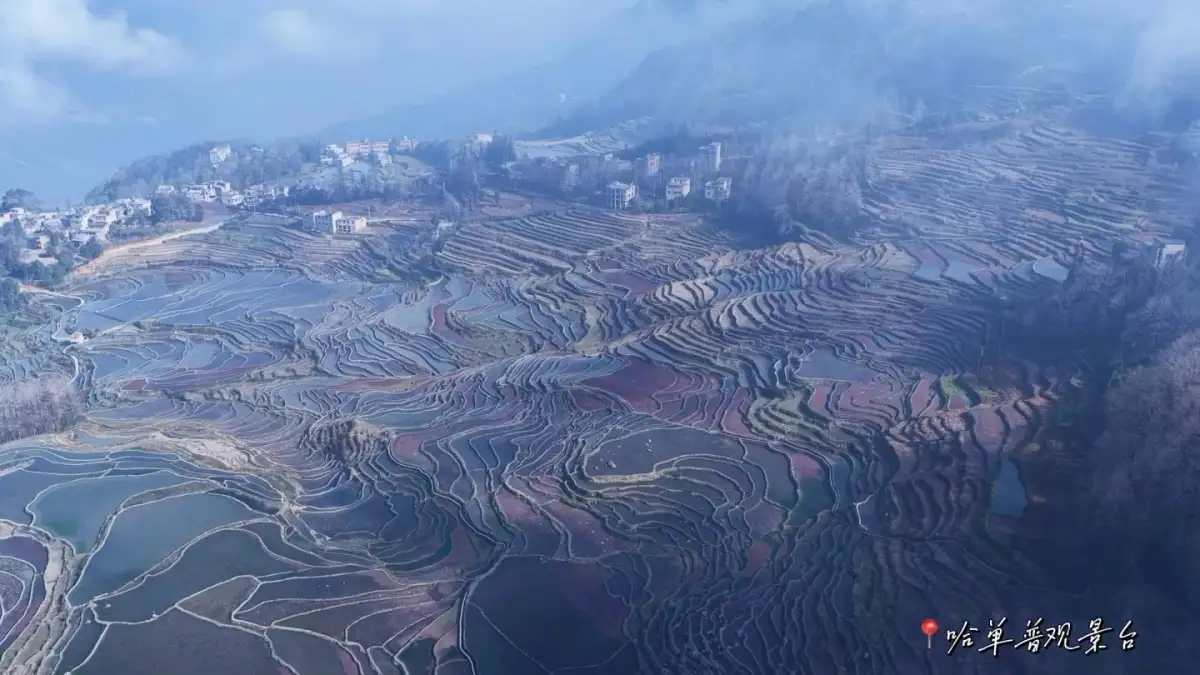
capture the vast, mist-shrouded, undulating terraced fields and mountain ridges. Photo:Traveling with a Bird · Original Post.
the differences between observation decks—judge with your eyes first, rather than by scores
the same field can take on completely different patterns depending on your vantage point. From a higher vantage point, the layers between the fields unfold more easily; from a lower one, nearby ridges may block the view of distant plots. The original post’s personal assessment illustrates this difference quite directly, but travelers can adopt a more consistent criterion: do you want to see the entire hillside, or capture a specific section of the water’s surface? Do you want the village to be included in the photo, or do you prefer pure lines?
upon reaching the platform, start by taking in the entire mountain range before gradually narrowing your focus. There’s no need to immediately squeeze into the densest part of the crowd. The front row doesn’t necessarily offer your preferred composition; sometimes, moving slightly to the side can actually connect the winding ridges with the village’s location. Shooting both wide-angle and close-up shots separately can also resolve the conflict of trying to capture the entire mountain while highlighting fine details in a single photo.
fog may affect these choices. When the distant view is obscured, the foreground—rice paddy ridges, water inlets, and rooftops—may become clearer; once the fog lifts, you can return to capturing the overall composition. A photography trip allows time to observe how the scene changes in one spot, rather than constantly switching vantage points. Just because the ideal colors didn’t appear one day doesn’t mean you can’t see the structure of the terraced fields. When the water’s surface is calm, the boundaries of the ridges are sometimes easier to make out.
From the Hope of Sunrise to the Rhythm of the Day
“Should we book a place to stay for the sunrise?” If witnessing the sunrise is the main goal of this trip, it’s worth prioritizing a discussion about where to stay the night before to ensure a smooth early morning departure. This reduces the pressure of rushing from a distance on the day of the sunrise, though it doesn’t guarantee a sunrise or sea of clouds. The editor suggests treating accommodation and early rising as options for securing observation opportunities, while also planning a theme that works well during the day—such as the relationship between villages and terraced fields.
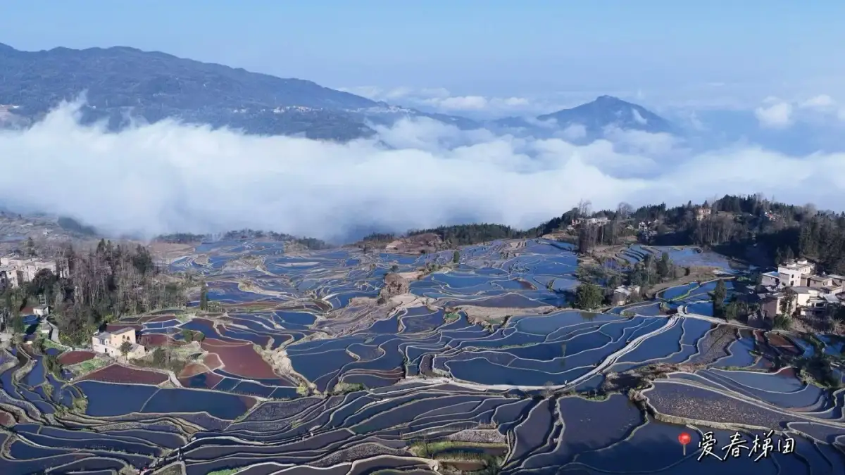
the irrigated terraced fields that unfold in layers between the sea of clouds and the village. Photo:Traveling with a Bird · Original Post.
After finishing the morning shoot, you’ll have plenty of time for breakfast and getting dressed. Rushing from one vantage point to another can easily turn the afternoon into a race to catch up on shots. Families traveling with parents are especially advised to designate one main observation point for the morning and another for the afternoon, using the time in between for meals and rest. If fellow photographers in the group wish to wait for the right light, they can first agree on a public, safe area for family members to rest, to avoid everyone having to stand for extended periods just to capture a single shot.
“Which spot is definitely the most beautiful?” There’s no one-size-fits-all answer. A single visit to a location is influenced by a combination of weather, field conditions, your specific vantage point, and personal aesthetic preferences. When comparing viewing platforms, first decide whether you prefer open hillsides, dense lines of vegetation, or landscapes featuring villages, then check the current access areas and on-site guides. Treating someone else’s experience with bad weather as a permanent flaw of the location can mislead future visitors.
move closer to the village to capture scenes of daily life in the frame.
Terraced fields are agricultural spaces in continuous use. Details of daily life at village entrances, under eaves, and along roadsides can help you understand the villages in the distance; however, you should obtain permission before entering courtyards, taking close-up photos of people, or observing them at work. Tourists often mistake “willingness to host” for “permission to enter any space”; asking in advance makes interaction more natural. When people are busy working, it’s more appropriate to keep a clear path for them to pass through than to ask them to pose for a photo.
when photographing workers, return the perspective to the subjects themselves. Explain how the photo will be used beforehand and obtain permission before shooting; without permission, limit yourself to landscapes and building exteriors along public paths. Travel narratives can still unfold through fields, displays of tools, or legally accessible exhibition spaces. When introducing a custom, confirm its name and specific context with a local guide to avoid portraying the practices of a single family as representative of the entire Hani community.
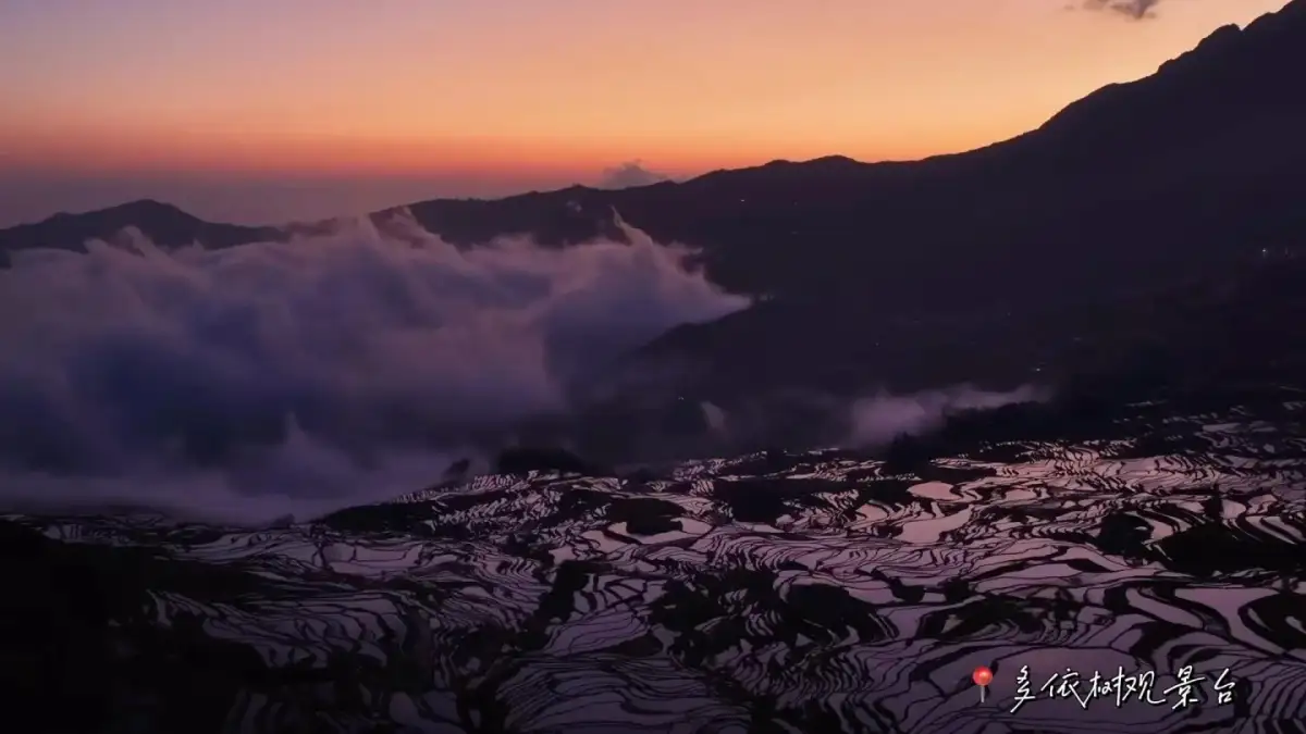
a sea of clouds, mountain silhouettes, and reflections on the terraced fields bathed in orange-red morning light. Photo:Traveling with a Bird · Original Post.
Field ridges and irrigation channels serve productive functions; their narrow, attractive lines do not automatically qualify as visitor trails. Observation points should be limited to open paths, viewing platforms, and clearly designated areas. Those planning to fly drones must separately verify applicable airspace regulations, scenic area management policies, and safety requirements; descriptions of previous flights by others in the original post do not constitute permission. Ground-level photography can also use a combination of foreground and background to clearly illustrate the relationship between hillsides and fields.
on the way back, let the photograph reveal the answer.
organize your Yuanyang photos in a very simple sequence: start with a wide shot of the entire mountain, followed by the connection between the village and the fields, and finally a close-up of the texture on the water’s surface. Captions can describe what you saw and what questions you’d like to ask. Color descriptions are drawn from observations made that day, while systematic explanations come from verifiable official sources—each has its place. A photo series like this preserves the aesthetic experience of travel without reducing agricultural life to a static backdrop.
For Chinese families visiting from abroad, this route is particularly well-suited for those who wish to take their time exploring the scenery over the course of a day and want to explain China’s agricultural landscapes to their children. If ease of travel is a priority, you can swap the multi-stop itinerary for a single viewing platform combined with a legally accessible cultural site. Please inform your itinerary advisor of your primary photography interests, willingness to wake up early, and the mobility needs of your travel companions to facilitate further coordination of transportation arrangements. The lines of Yuanyang are worth capturing, and the people and water that sustain them are equally worth seeing.
Source and Editorial Notes
This article is an original travel interpretation compiled by the Dongxing Travel editorial department based on cited materials; it is not a firsthand account by the author. The full text of the original post has not been reproduced; accompanying images are used within the scope of authorization and are credited to the author and the source of the original post. They do not serve as proof of actual travel experiences or services provided by Dongxing Travel.
Xiao Liu · Sculptures of the Earth · Travel Notes; Verified/Organized on: October 3, 2026.
Travel Review: "Lajia Bird" · Yuanyang Hani Terraces: From Pounding to Pulling · Travel Notes; Verified/Organized on: October 3, 2026.
Food and Agriculture Organization of the United Nations (FAO) · Hani Rice Terraces · Official source; Verified/compiled on: October 3, 2026.
UNESCO World Heritage Centre · Cultural Landscape of the Red River Hani Terraced Fields · Official source; Verified/compiled on: October 3, 2026.