Decide what you want to take away from the experience first, then decide where to start your ascent
Some wish to etch the “Eighteen Bends” into their memories; others hope to stand atop the mountain and gaze upon the surrounding peaks; still others are genuinely interested in why Mount Tai holds such a special place in Chinese culture. These three expectations will result in three very different route maps. On a first visit, translating everyone’s wishes into a single goal—“reaching the summit”—often results in an overly one-dimensional itinerary. Before setting out, it’s more worthwhile to discuss which part of the experience appeals to you most, and whether your travel companions are willing to invest the same level of physical effort into it.
A Xiaohongshu post titled “Classic Hiking Routes on Mount Tai!” lists the palaces, temples, stone carvings, and key hiking points along the way in sequence, evoking the anticipation of exploring as you walk; the “Six-Hour ‘Lazy Person’s’ Summit Hike on Mount Tai,” on the other hand, emphasizes segmented walks connected by public transportation. Both cater to the different priorities of various travelers. Based on this, this article proposes a method for selecting routes. The basic composition of the paths refers to the information provided by the Mount Tai management authorities; specific transportation operations are subject to official information at the time of visit. Do not treat an individual’s completion time as a goal for the entire family.
As a dual World Heritage Site of both cultural and natural significance, Mount Tai makes this issue particularly intriguing: the inscriptions, architecture, and trees along the mountain trails are not merely background elements to be glossed over before reaching the summit. Even the foothills can offer a meaningful journey. You can start by reading this site’sIntroduction to Mount Tai as a Destination, establishing a broad framework linking the mountain and its culture, and then using the comparisons below to determine where to focus the day’s efforts.
Choosing the Red Gate Route: Treating the Climb Itself as the Main Attraction
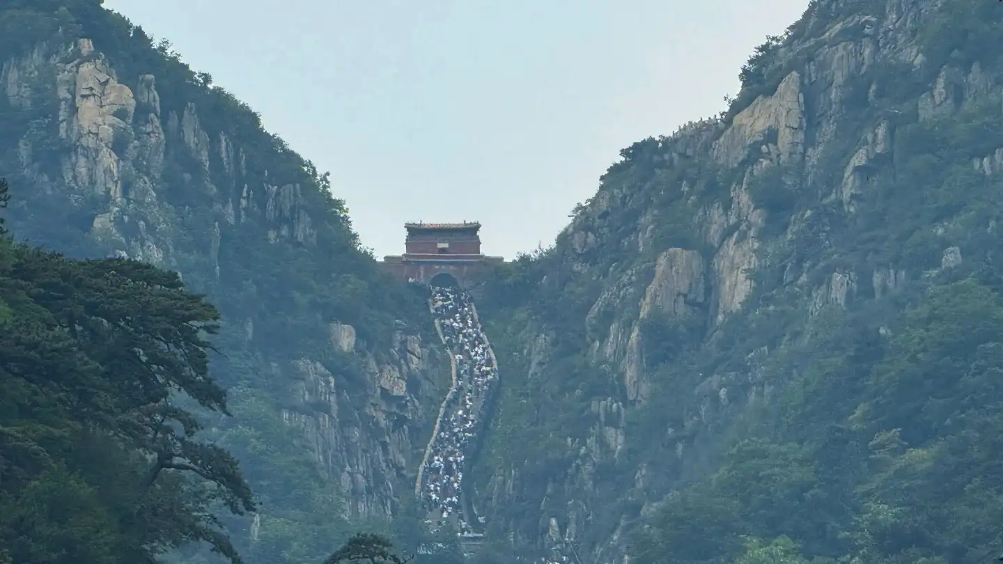
Hongmen Trail lies in its sense of continuity. The Mount Tai management authority’s route description lists various locations—such as Hongmen, Zhongtianmen, the Eighteen Bends, and Nantianmen—as well as the palaces, temples, and inscriptions along the way. As you proceed along the mountain trail, your field of view shifts with the steps, the trees, and the slope: first, you see nearby tree trunks and archways; then, you take in the mountain cliffs, stone steps, and structures higher up. This sequence transforms elevation from a mere geographical figure into a spatial relationship that your body gradually perceives.
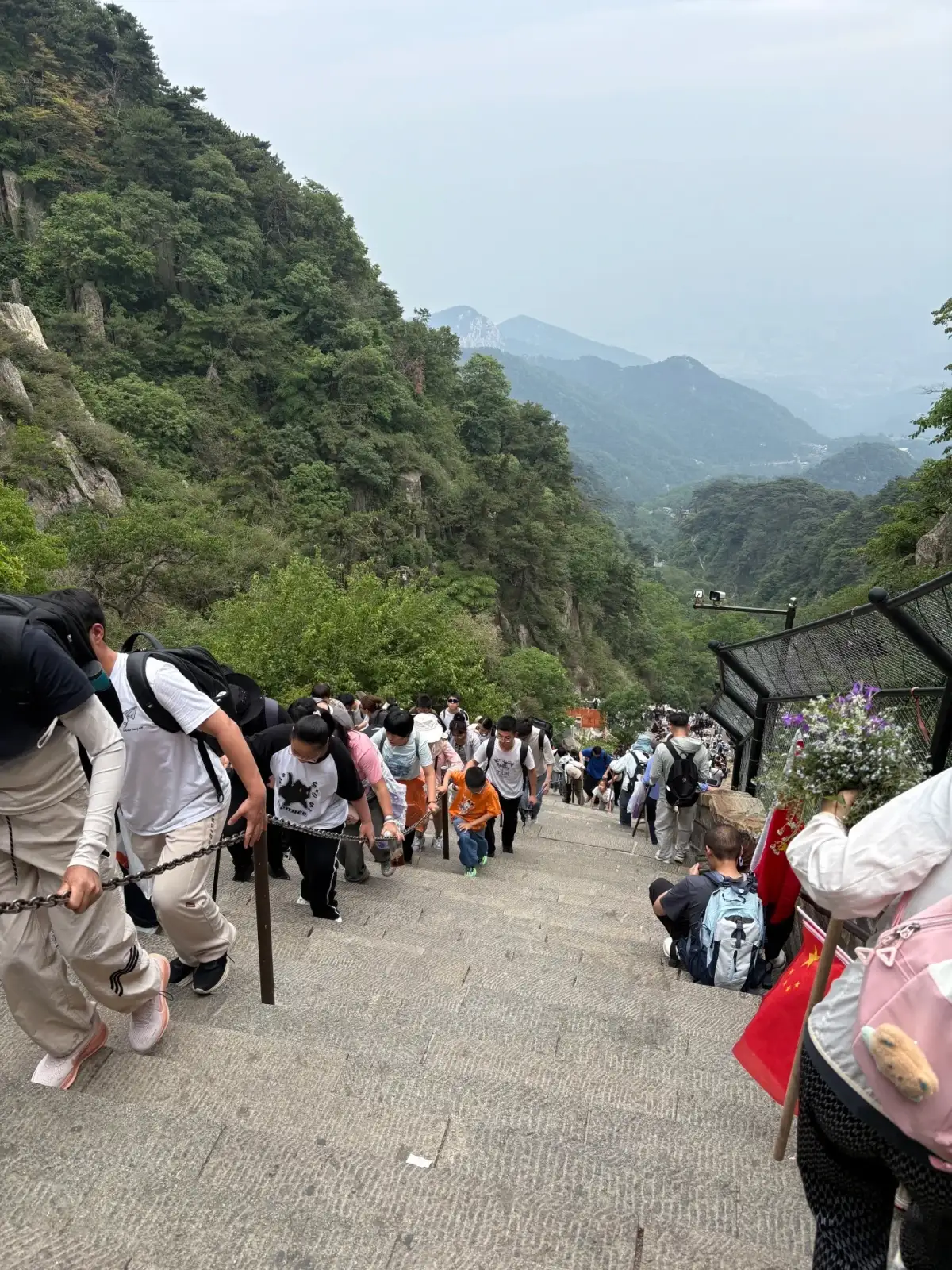
Hikers on the stone steps of Mount Tai, with the surrounding forests on either side. Photo:Click, click Zyzz · Original Postalong the mountain trails.
Those who find this approach suitable typically view walking itself as part of the journey, rather than merely a means of transportation. Upon reaching the same mountain gate, those who have just walked up the mountain trail and those who have arrived via transportation connections may have different perceptions of the gate’s location. The former are more likely to remember the turns, pauses, and gradients, while the latter have more energy to appreciate the architecture and distant views. Both experiences have their own value, and route selection should prioritize the experience that is most important to the traveler.
who appreciate the culture along the way must also allow practical space for viewing. Upon encountering an inscribed stele, stop first at a spot that does not obstruct traffic, then decide whether to read the text, examine the composition, or listen to an explanation. If you spend the entire journey focused solely on the destination ahead, the stone inscriptions will become nothing more than signs flashing by in your field of vision. Conversely, reading every inscription you encounter may disrupt your walking rhythm. We recommend selecting a few inscriptions that interest you most, treating the other sites as spatial landmarks, and maintaining a pace that allows you to keep moving forward.
The most important consideration for the entire climb is the dynamics among companions. One person may find the slope challenging, while another may be more concerned about the remaining distance; some stop to view a stele, while others stop to rest. Agreeing before departure on whether to hike the entire route together and under what circumstances to adjust goals can reduce impromptu disagreements along the trail. The route should be based on an experience that the slowest hiker can comfortably participate in, rather than being dictated by the fastest hiker’s ideal pace and requiring everyone else to keep up.
Selecting a segmented ascent: Preserve the upper-mountain scenery while reducing continuous walking in the initial section
Tianwai Village Line explains the connection between the scenic area’s transportation system and Zhongtianmen. Upon arriving at Zhongtianmen, the combination of walking and cable car options presents another layer of choices. Therefore, the phrase “taking a vehicle up Mount Tai” does not fully describe the entire journey: it must also address where the vehicle goes, how to proceed from there, and what attractions one wishes to see once at the upper reaches. The value of a segmented approach lies in reserving your limited energy for the sections that truly interest you, rather than imagining the entire journey as one that requires no walking.
If you wish to see the upper mountain landscapes but have little interest in repeatedly climbing steps, this approach makes it easier to make clear trade-offs. You will still need to move between the upper and lower stations, walking sections, areas around buildings, and viewing points, and you will still encounter changes in weather and crowd levels. Breaking the route down into practical segments helps determine whether it is suitable for your travel companions. A simple “effort-saving” label cannot replace an understanding of the walking environment—and certainly cannot directly imply that wheelchairs or strollers can navigate the entire route.
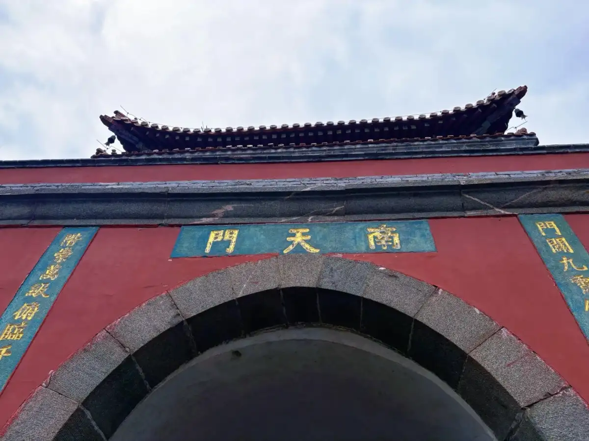
The South Heavenly Gate archway, plaque, and red walls at Mount Tai. Photo:Click, click Zyzz · Original Postalong the mountain trails.
If you wish to retain some sense of the climb, you can focus on the walking section above Zhongtianmen rather than relying on transportation connections at both ends. This will result in a more concentrated—and possibly steeper—hiking segment. When choosing this route, treat the “Eighteen Bends” as a staircase that requires serious effort, and allow for time to take in the views, rest, and adjust your plans. If you use all the time saved on the lower section to make up for lost time on the upper section, the purpose of dividing the hike into segments is lost, and you’ll ultimately return to the pressure of completing the entire hike within a single timeframe.
Another easily overlooked difference is the return journey. Your energy level on the ascent does not necessarily reflect how much energy you’ll have left after descending—especially when you still need to transfer to other modes of transportation, return to your hotel, or catch intercity transportation. The editor recommends first mapping out the entire return journey, then working backward to determine how long you can stay on the mountain. If a specific transportation connection is critical to the family’s completion of the route, confirm its operation for that day before departure. Also, be prepared to shorten the route if the weather changes, and plan alternative activities off the summit in advance.
Selecting Foothill Culture: Placing Mount Tai’s Significance Back in the Context of the City and the Mountain’s Foot
Spending a day at the mountain’s base can center on cultural spaces such as the Dai Miao, followed by exploring the surrounding area on foot. This is not simply shortening the original summit-ascension itinerary, but rather reframing the question: How do people establish ritual spaces at the foot of the mountain, and how do the architecture, trees, and the mountain itself mutually refer to one another? For those who enjoy discussions of architecture, calligraphy, and history, this question alone is sufficient to constitute a day’s theme, without needing to measure the experience’s fulfillment by whether one reaches the summit.
at the mountain’s foothills differ from those at higher elevations. Here, one can focus on the transitions between courtyards, the front and side views of the halls, the placement of inscriptions, and how trees alter the sense of space. When standing before a stele to read the inscriptions, there’s no need to simultaneously worry about how many steps remain. This pace allows for leisurely discussions with children or companions with different cultural interests, and it also makes it easier to create natural pauses between reading, resting, and dining in town.
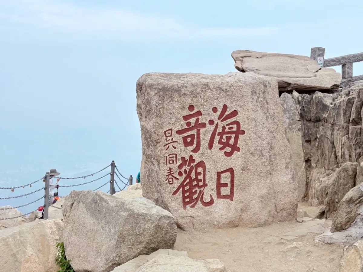
The stone carvings depicting the “Sunrise over the Sea” spectacle at the summit of Mount Tai and the guardrails. Photo:Click, click Zyzz · Original Postalong the mountain trails.
It is worth noting that “not hiking” does not mean there is no walking at all. Historic architectural spaces may feature steps, thresholds, or long distances across courtyards, and weather conditions can also affect the comfort of your stay. When planning your itinerary, start by selecting a primary cultural site and treat observations of the surrounding neighborhoods as optional additions or omissions. This way, even if your interest in the visit turns out to be greater than expected, or if your companions need more rest, your trip will still have a clear focal point, and you won’t have to constantly switch between multiple locations just to check items off a list.
Three types of travel groups: How to turn trade-offs into concrete plans
Two adults who both enjoy hiking can start by discussing the Hongmen Line approach, but it’s best to clearly separate cultural exploration from physical goals. If one wants to stop to read the stone inscriptions while the other just wants to keep climbing, they can try to find a common pace at a lower elevation before deciding on their goals for the upper section. What both truly share is likely the experience of the trail itself, rather than reaching the summit at the exact same moment. Treating photo breaks, water breaks, and reading the inscriptions as natural pauses will better capture the essence of this route than constantly urging each other on.
For families accompanying elderly relatives or those with varying tolerance for stair climbing, it is more suitable to first compare the segmented and foothill options. Criteria for decision-making can include daily continuous walking ability, personal comfort with stairs, and post-hike plans. People who enjoy panoramic views but dislike hiking, and those who appreciate ancient architecture but aren’t concerned with reaching the summit, do not need to follow the same ideal route. If you hope the whole family will stay together throughout the trip, choose the shared sections that everyone can enjoy, and put personal preferences on the back burner.
photography enthusiasts can first decide which aspect of Mount Tai they wish to capture. Inscriptions among the trees, continuous stone steps, and the silhouettes of hikers from behind are well-suited for a narrative along the mountain trails; the interplay between the upper peaks and architecture is best captured by focusing on the higher elevations; and the scale of courtyards, tree shadows, and steles lends itself to a closer look at the mountain’s foothills. Figures in the distance can help establish the setting, but you should ask for permission before taking close-up shots of strangers’ faces. Images without people aren’t the only valuable ones; the mountain trails in use are also part of your travel memories.
Do not make sunrise viewing or reaching the summit a mandatory requirement for all itineraries.
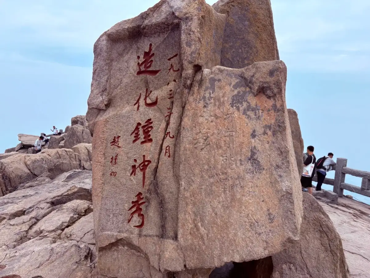
The “Mount Tai: A Masterpiece of Nature” stone inscriptions and surrounding rocks. Photo:Click, click Zyzz · Original Postalong the mountain trails.
sunrise along the mountain trails is a compelling visual draw, but adjusting your departure time for it will consequently alter your rest schedule, visibility conditions, and plans for the following day. Those who enjoy cultural exploration may not need to sacrifice daytime sightseeing along the way for the sake of a weather-dependent scene; similarly, families traveling together may not be well-suited to follow online narratives about night hikes. The editor recommends finalizing your daytime route first, then determining whether it is truly necessary to include the sunrise as a goal, to avoid letting a single scene completely rewrite the conditions of the entire trip.
Similarly, reaching the summit does not automatically mean you have truly understood Mount Tai. You might recall how a flight of stone steps winds through the forest, how an inscribed plaque blends with the mountain face, or how a temple connects the near and far vistas. These specific memories linger longer than the vague notion of “having climbed it once.” For those with a keen interest in culture, seeing only a few things along the way but being able to articulate the relationships between them is often more meaningful than reaching more locations.
Before setting out, you can write down a shared family goal in a single sentence, such as “We want to hike a section of the trail and read two inscriptions,” “We want to enjoy the upper mountain views while conserving energy for the return trip,” or “We want to understand Mount Tai’s ceremonial space starting from the Dai Miao.” Then, let your route, transportation, and order of stops align with this statement. When changes arise, prioritize preserving the core experiences and minimize peripheral travel. You can explain these choices to your travel companions or simply share them with a travel advisor for discussion; this approach is far easier to implement than a route defined solely by a starting point and an endpoint.
Finally, consider Mount Tai within the context of a broader Shandong itinerary: if your itinerary includes the ritual spaces of Qufu, the coastline of Qingdao, or urban walks later on, the physical exertion you expend today will affect the quality of your experience in those subsequent destinations. This sitetourism routescan serve as a starting point for discussing regional combinations, with the specific sequence to be confirmed by the advisor based on actual transportation conditions. What truly matters at Mount Tai is deciding which kind of experience you’re willing to devote your energy, attention, and time to; the route’s name is simply the answer that follows this decision.
Sources and Editorial Notes
This article is an original travel analysis compiled by the Dongxing Travel editorial department based on cited materials; it is not a firsthand account by the author. The full text of the original post has not been reproduced; accompanying images are used within the scope of authorization and are credited to the author and the source of the original post. They do not serve as proof of actual travel experiences or services provided by Dongxing Travel.
Kaku Kaku Zyzz · Classic Hiking Routes on Mount Tai! · Travel Notes; Verified/Compiled on: October 3, 2026.
Aha (Xinjiang Edition) · ⛰️ Mount Tai: 6-Hour “Lazy Hiker” Summit Hike 🏅 · Travel Notes; Verified/Compiled on: October 3, 2026.
Mount Tai Scenic Area Management Committee · Mount Tai Hongmen Tourist Route · Official source; Verified/compiled on: October 3, 2026.
Mount Tai Scenic Area Management Committee · Tianwai Village Tourist Route · Official source; Verified/compiled on: October 3, 2026.
UNESCO World Heritage Center · Mount Taishan · Official source; Verified/compiled on: October 3, 2026.